Showing posts with label Tag Game. Show all posts

Sunday, September 18, 2022

I'm Still Around


If you have been wondering where I went, I am still alive and kicking. I just have had so much going on that I have not had nearly enough time to ride. Retirement can be like that, I'm told. It almost seems that I am busier now than when I was still working, now some eight years ago.

Mostly, I have been riding on familiar roads to favorite places not too far from home.

The South Carolina Tag Games on the ADVRider forum are fairly frequent places where I participate. It is sometimes a challenge to find the tags either in the entire state of South Carolina or just in the upstate.

If you are in the area, join in the fun. Enter -- advrider sc tag o rama -- into your search engine and you should find both SC tag games.

I hope to see you on the road soon.

.


Monday, November 6, 2017

60,000 Miles and Counting

.
Well, it has happened.


....I have ridden my Ninja 60,000 miles!....


It has taken me since July 18, 2015 to log these last 10,000 miles.  I'm kind o' slow, I guess. 

Here's a recap, for those of you who don't know, I started riding a motorcycle (this motorcycle) in late 2007, at the then youthful age of 57.  I had been thinking about it for a long time, and a colleague at work encouraged me.  (Thank you, Jeff.)  I took the MSF Basic Riders Class, bought an almost new motorcycle, and set out to learn how to ride it.

Along the way, I have met people I would otherwise not have met, and I have gone places I otherwise might not have gone.  Some of those places are chronicled here in this blog of mine, along with the progression of learning how to ride, and a few other topics that interest me and maybe you, too. 

This momentous event -- reaching the 60,0000 mile mark, I mean -- took place on September 26, 2017, almost exactly ten years after I bought the bike.  In those ten years, I have had the bike out of the garage 728 times.  (Yes, I count.  I'm an engineer, don't you know.)

I note that I have not ridden as much since I retired from the job as I had anticipated.  It appears that I have been too busy with other things to ride as much!  I'd like to go more often, but I also can't seem to find a riding buddy who isn't working, and who wants to go to the places and at the pace I do.  (Let me know if you want to ride some time.)

I also have not written as much on these pages as I used to, because I tend to ride to many of the same places that I have already written about, so I don't want to bore you.   Sassafras Mountain (the highest point in South Carolina), Whitewater Falls, Table Rock State Park, Saluda North Carolina, the Blue Ridge Parkway, and a few other places that are beautiful and great places to ride are all frequent repeats.

One infrequent place I did go with a friend was the Wheels Through Time museum in Maggie Valley North Carolina back in July.  He rides at about my pace, and we had a great time riding up US-178, NC-215, and the Blue Ridge Parkway.  I enjoyed seeing the museum again, but my buddy had not been there before.  One of the museum's mottoes is "Our Visitors Are Like Family".  That is fitting.  Every time I have been there, each of the staff was friendly, knowledgeable, and helpful in every way. 

Unfortunately, just as we were fueling up for the return trip, it began to sprinkle, then rain, then rain hard, then downpour for a good long distance on the way back home.  Noah and his Ark would have been welcome in a few places.  It dried up not long after we entered South Carolina.  I hadn't taken my rain gear 'cause it didn't look like rain, so I was soaked to the skin by that time.  We took it slow in the rain, and arrived without mishap.  Unfortunately, another motorcyclist was not so fortunate, as we passed the scene of an accident where he went down near Balsam Grove, NC. 

I have also grabbed a few tags on the ADVRider Upstate SC Tag-O-Rama, here, here, and here, and set a few challenging new ones.  (If you are interested in playing, all of the various South Carolina tag games are listed on this page.) 

I suppose you could say that I am mostly keeping to myself when riding. 

[Come on, Bucky, tell us where this latest mileage achievement occurred.]

Well, first a little history about where some previous milestones were reached:

Now, where did I reach 60,000, you ask? 

At a cemetery.

Yes, that's right, at a cemetery.  (So what was I supposed to do, fake the record of this historical event for the purpose of being in a more interesting spot?  I think there is too much fake news these days.)

Here's where it is, on SC-288, also known as Table Rock Road after the nearby geological feature and state park of the same name.

Click here for larger, interactive map.
Notice that the twisty US-178 is to the west, Table Rock State Park is toward the northeast, and the thriving metropolis of Pumpkintown is to the east. 

Actually, it turns out that this cemetery is an interesting place after all.  It is the Chastain family cemetery, whose several generations of occupants were born in 1743 or after, and who died in 1924 or before.  There are at least nine bodies buried here.

Here are some photographs.


That last photograph is the largest monument, and is nearest the road, announcing the presence of the graveyard.  Here is a list of those buried there, along with their relatives names:

 
Closer photographs of the stones are here, taken from the Internet.


This John Chastain (John Jr.) lived during the Civil War, and served in the Confederate Army. 
The most interesting marker for a man buried here, I think, is for one Rev John "Ten Shilling Bell" Chastain Sr., inscribed at the top on this more modern stone, along with a history of the family. 


Reverend Chastain was born in 1743 in Manakintown, Goochland County, Province of Virginia, fought in the Revolutionary War, and was a Baptist preacher, who traveled up and down the frontier, preaching and establishing churches.  He was one of the founders and the first minister of the Oolenoy Baptist Church, now located at 201 Miracle Hill Rd, Pickens, South Carolina, and founder of Crossroads Baptist Church.  

If I counted correctly, Reverend John fathered fourteen children by two wives.  
Click here for larger, interactive map.
I am sure, by now, that you are wondering about Reverend Chastain's nickname.  Well, legend has it that John Chastain's preaching voice was so loud and so ringingly clear that he was given the nickname of "Ten Shilling Bell".  Oh, that preachers were that forceful and eloquent today as he, perhaps was.  You can read more about the Chastains by clicking the links at the end of this posting. 

Getting back to the bike, there have not been any troubles with the bike in the last 10,000 miles.  It has been a joy to operate. Since I bought the bike slightly used, the odometer showed 60,640 miles total when I reached this milestone. 


Here is the victorious rider: 


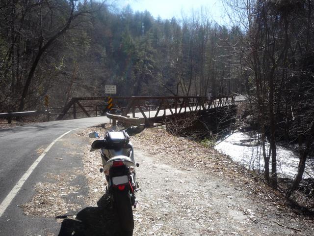
I went on a little further that day, meandering around the country roads near the historic spot.   One place I went is to Table Rock State Park, stopping at the Pinnacle Lake overlook,

That bike kept wanting to pose for the picture.

and at the lodge,

Again, posing

and to see Table Rock itself, viewed from the park road. 


The day was a short one -- only 84 miles, but quite enjoyable.  When I first started riding, I never dreamed that I would ride 60,0000 miles and more on two wheels. 

I'll keep on writing here as interesting things come to mind, especially landmarks and good roads. 

See you on the [hopefully long] road ahead. 


Bucky's Other Milestones:

Chastain Cemetery References:
.
s ridden miles i have ridden motorcycle mileage miles i have ridden the motorcycle miles i have ridden this motorcycle miles i have ridden the bike miles i have ridden the scooter mileage record mileage threadhow far have you ridden distance I have ridden the motorcycle distance i have ridden this motorcycle distance i have ridden the bike distance you have ridden the scooter distance you have ridden the motorcycle distance you have ridden this motorcycle  distance you have ridden the bike distance you have ridden the scooter.

Wednesday, May 4, 2011

Saluda North Carolina -- a Tag Grabbed, and More

.
April 2, 2011, about a month ago.

I had to find it.  What?  Another tag by Stretch in the CarolinaRiders Forum Tag Game.  Recall that Stretch is a pretty good one at posting tags that are interesting and somewhat difficult to findAnd here is another one Stretch posted.  I have prided myself in finding a few of his tags, but this one looked quite interesting to me because of my engineering background.

It is an old waterwheel, and his clues were are follows: 
"Here's a tough one.  The Carolina mountains are covered with old water wheels. What makes this one unique is its proximity to the water.  Bonus points if you can tell me how it worked.
"If you ride down a road in NC with 21 hairpins in about 2 miles (there's only one), you'll find the new tag about 11 miles from the last hairpin turn."
One of the other inmates [members] on the forum posted this:
"Can I ask questions?
"For instance; can I find this road with "21 curves in about 2 miles out of Saluda, NC?"
Stretch replied:
"It may be near Saluda. I'm having a little trouble remembering just now .
"On the return trip I recommend passing the unnecessarily twisty road and taking the next right instead. I find it a more enjoyable ride and it will return you to the same town, whatever that town may be."
 
...and provided a couple more clues: 
"When a group of businessmen from Spartanburg, SC needed more power for their mills, they bought land in NC to build two dams. This mill wheel is near one of the two resulting lakes but predates Dam.
"Look for a road named after a famous Golfer."
Well, one cerebral part of motorcycling is to figure out clues like this.

I am sure the twisty road Stretch is referring to is the most contorted piece of civil engineering I know of around here, Green River Cove Road.  I tested out a downhill rear-braking technique here last year, but I don't like the road much because the turns are very sharp, and visibility of oncoming traffic is poor.

I carefully map out another eleven miles from the last (lowest elevation) turn on that road, and find that it is beyond the northeastern end of the road, so I must have to go one way or the other after that.  I looked up waterwheel, but found nothing close.  Well, the only golfer I know of besides Tiger Woods is Arnold Palmer (being the sportsman I am), so I try Palmer Road.  There is one up that way. We'll see if the clues will lead me to the right spot. 

I finish up a Google map, print it, slide it into my tank bag, and head out.  It is 42 degrees, so I bundle up a bit, but not too much, as it is supposed to reach about 70 later. 

I go north on SC-135, then SC-186, US-276, SC-11, US-25, and turn off on the Greenville Watershed Road.  This is a moderately twisty road that winds its way uphill through a watershed for a reservoir from which the city of Greenville gets some of its drinking water.  There is no stopping allowed along this road to help prevent water pollution in the lake.  The road is used extensively by bicyclists, so you have to be careful, since some of them ride in the middle of the lane, it is slow going for them going uphill, and there are blind curves in some places.  The pavement has become rather poor, with lots of cracks and potholes.  It is pleasant enough road nonetheless, but the posted speed limit is probably the most prudent way to travel here.


View Larger Map of the Greenville Watershed Roads


Soon enough, I reach the town of Saluda.  I park, and go right over to the M. A. Pace General Store to visit Mr. Robert Pace, son of the original owner who opened the store in 1899.  He is getting up in age now, so I want to say hello to him once again.  Each time I have come through here on the bike, I have stopped, and every time, for some unknown reason, Mr. Pace has commented on the fact that I look like I just stepped out of a spaceship.  Strange, don't you think? 

Here is a clear view of his store from my parking spot.  

I walk over to the front door.  Sadly, I find a sign that says he passed away in his sleep last October at the age of eighty-seven.

His last few years were spent meeting visitors and explaining the history of the business, the steep railroad grade that crests here, and of Saluda itself.  That seems like a good close to a life here on earth. 

Even though it has been several months since he left this world, the stock in his store is as it was.  Only the refrigerated items have been removed.  The ancient stock of dry goods remains, as do the more modern items. 
Those are boxes of new old stock shirts, and shoes on the shelves to the right. 
 

Mr Pace was a former insurance and real estate broker, and a 1945 graduate of Wofford College. He served on many committees and boards that were instrumental in bringing business to the area.

Here is a picture of Mr. Pace I took in April of 2010.
Although I did not know him well, I will miss him. I had hoped to be able to shake his hand just once more. 

I walk down the surprisingly busy street -- after all it is a beautiful day to be out in the mountains -- to the offices of Saluda Realty and Construction.  I find Mrs. Eargle sitting outside in a rocker with her dog leashed nearby.  I speak with both, pet one of the two on the head (guess which one), then inquire of Mr. Eargle's whereabouts.  I venture inside the office where I am directed, and find him at work at his desk.  As soon as he turns, he flashes a huge grin, and says he remembers me from my last visit.  I am flattered.  Maybe the clothes are the reason he recognized me. It had worked with Mr. Pace, didn't it?  Or maybe Mr. Eargle is just one of those fellows who remembers everyone he meets.  He seems to be genuine, not put on, in his treatment of others.

We chewed the fat for a few minutes.  Mr. Eargle told me the story of the old Thompson’s Store and Ward’s Grill (referred to in my earlier posting and pictured below).


A gentleman named Clark Thompson now owns the store and grill, and writes a blog called Saluda Memories.  Mr. Thompson was born and raised here, but went away to college and to work elsewhere.  He returned in 2010 to keep the spirit and nostalgia of the Old Store and Grill alive.  Mr. Eargle's construction company has been restoring the structures. 

After I leave Mr. Eargle's office, I give their dog a little more attention, then survey the remainder of the main street, and saddle up again.  I want to get that waterwheel tag before anyone else does.

Off I go, leaving Saluda (at Pushpin "A") toward the northeast, Interstate 26 (Pushpin "B"), and beyond.


View Larger Map

I could take the first left after 26, Green River Cove Road, the contorted one that Stretch referred to in his clues, but straight ahead, Holbert Cove Road, is more uniformly twisty, with none of those very tight turns all packed together.  And it ends up in almost the same spot.  The road has recently been tar and chip surfaced, so it exhibits a uniformly good grip with no potholes or cracks.  The work must have been done long enough ago that the loose stone has all dissipated, so I cruise along smartly.  The only thing is that there are few advisory speed signs, so it is difficult to know whether there is a decreasing-radius turn or some other hazard lurking somewhere ahead.

After about 9-1/2 miles on Holbert Cove, I reach Silver Creek Road (Pushpin "C") and make a left.  I pass this end of Green River Cove Road, then after 1.7 miles from where I turned onto Silver Creek, I see Palmer Road to the left and Lake Adger Road to the right (Pushpin "D").  I take Palmer Road and begin watching closely for my target.  I come across it, in about 1.2 miles, on the right.

Here it is, at Pushpin "E": 
35°19'42.49"N   82°15'9.72"W
The waterwheel is an example of an overshot style.
Types of waterwheels are described on this website.  

The source of the water was Bright's Creek a bit upgrade -- toward the left in the picture above.

Up a steep slope from my parking place, there is a corrugated steel pipe, shown below, that directed water from upstream to the top of the wheel, probably pouring onto the wheel from a wooden flume, now gone. 

Water exited the wheel through a cut or culvert just in front of my bike, joining the nearby creek across the little gravel driveway here.

The wheel has a large bull gear on the side that engaged a much smaller pinion, providing an increase in RPM to drive a generator.

There may have been a mechanism to govern the flow of water to maintain the correct voltage and/or frequency. (You electrical engineers: Was this likely to be a DC or AC generator?) If you want to do a few calculations on the power provided by waterwheels, here is a website to help. 

This photo shows the pipe at left-center, upstream of the wheel, at the entrance to Bright's Creek, an upscale golf development with a Tom Fazio-designed course.  (Now I know another golf-related name besides Tiger Woods and Arnold Palmer.)  
Wherever the pipe connected with the creek upstream must have been some distance away judging from the height of the pipe versus the creek bed beneath the bridge.  I couldn't follow the likely path of the pipe any further because the golf development is gated, and I'm not a resident.  That's OK, they pay just a bit more than I do for a place the live -- lots start at $200,000 each, so a little extra privacy is their privilege. 

A little waterwheel history:
The waterwheel was installed in the 1950s by Dr. Marion C. Palmer, landowner and lover of gadgets, according to an account written in 2003, found on the Tryon [NC] High School class of 1971 website. (Search for "water-wheel".) The story speaks of the lady of the household, Mrs. Palmer, having to tell the tenant farm family to turn off their lights so she could use her electric iron. That leads me to think the output of the waterwheel was around 1000 watts, or about 9 amperes at 110 volts. Commercial electricity reached this area in 1962, with telephone service following.

A view of the area.  

Well, it is pretty country here, but I have to get back, so I retrace my path back to Saluda on Palmer Road,...

...Silver Creek, and Holbert Cove Roads, then head west on US-176.  There are a couple of tight turns on this last road, one in front of a quarry entrance.  That one can be treacherous due to spilled gravel. 

I turn south on US-25, then veer off onto Gap Creek Road, hit SC-11, then SC-8, SC-135, and home to Easley.  The complete trip map is shown here:


View Larger Map


I don't rush, but I also don't tarry on my way back home.  After all, I have to post the tag grab photo before someone else does. 

By the way, if you remember, Stretch challenged the tag grabber to describe how the waterwheel worked.  I think I get the extra credit for doing so.  (Whew, I'm glad that those four years of engineering school weren't wasted after all.) 

Once at home, I rush to the computer, post my photo, and I can now lay claim to bragging rights, at least until someone finds the new tag that I have posted. 

I have ridden 147 miles today, in beautiful weather, looking at natural scenery and an engineering project not quite as old as I am.  You can't beat a day like this.  Thanks Stretch for providing an interesting tag in a beautiful part of the country.

Oh, here's the new tag I posted.  See if you can find it. 

Clues:
"This bridge spans a small river.
The river has something to do with twelve miles, and it must be tired -- as it needs to lay.
The bridge is not far from woodside two.
If you go further on the road you will find Elfwing and Magic Mountain, both centrally located."


If you go:

.

 .

Monday, January 17, 2011

Grabbing a Tag at Bloomer's on a Cold Windy Day

.
January 8, 2011.  I have written before about the local tag game posted on the CarolinaRiders forum.

If you don't know about tag games, the rules of this one are as follows:  

  • Who ever is "it" takes a picture with his bike in the shot.
  • The first person to find the location where the picture was taken (making a claim or grab), and take a picture with his bike in the same place becomes it and may now post a picture of his bike in a new location (this may be an older picture).
  • All claim photos must be "fresh"... no using old files from previous trips.
  • All photos must be taken in publicly-accessible places.
  • Your bike must be in the picture, but you don't have to be.
  • You must take the picture yourself.
  • If your tag has not been figured out in 1 week, you need to leave some more clues.
  • If your tag has not been figured out in 2 weeks, replace it with a new tag.
  • All tags must be within a 125-mile radius of the Holly Springs Country Store at the intersection of US-178 and SC-11.
  • When you are claiming a tag, you need to post your picture and a description of the location.
  • The first to post a picture of his bike at the correct location with a description becomes "it" and wins that tag.
  • The prize for winning a tag is bragging rights and the ability to post the next tag location.
Well, I have grabbed tags a number of times (here, here, here, and even once over at the Adventure Rider Forum), and I plan to do so today. One of the guys who posts on the forum is Stretch, and he posts some very good tags with cryptic clues, so they are sometimes hard to find.  He rides a lot and seems to know every nook and cranny of Upstate South Carolina, Western North Carolina, Northern Georgia, and further, and has photographed a lot of potential tags. 

Here is his tag photo and his clues, posted on January 6:


  • It was a gas station, 39 miles from Six Mile, 25 miles from Pumpkintown, 8 miles from Tooter Town, 4 miles from Gramling, and only 1/2 a mile from "Junkie John".
  • This is one of two old deserted gas stations at a crossroads that does a fair impression of a small but windy city.
  • This will be especially easy if you know Junkie John.  
  • This one may even stump Bucky 

What does he mean, "This one may even stump Bucky."?  And that little guy sticking his tongue out; that is too much.  Stretch has thrown down the gauntlet and I intend to find this one.  Pronto. 


I start searching on Google Maps.  I can find Six Mile South Carolina, and I certainly know where Pumpkintown is, and Gramling is easy.  Even Tooter Town (230 feet wide, population 11) can be found on Google.  Little Chicago is also surprisingly easy, but I can't find anything about Junkie John.  I plot these places on a Google map, print it, and place it in my tank bag for reference.

I watch the weather the night before, and it calls for a low of 32 degrees.  It has not rained for a few days, so the roads should be free of ice, though I will have to keep an eye out for random wet places that may have frozen.  Sure enough it is 32 degrees in the morning.  I suit up with one extra layer, fire up the bike, turn on the grip heaters, and off I go. 

Soon, I am glad I put on the extra layer.  The wind is gusting to35 mph.  I am at times buffeted from side to side, and heading into the wind amounts to a 95 mph treat.  Going with the wind is eerily quiet, however.


I follow my map, but after I get beyond familiar roads, there is something wrong.  Either some of the map road names are not right or I have missed them.  Naturally, I don't stop to ask for help; being a man -- you know that is built-in.  I stop at a few intersections to restudy my map, make a significant number of U-turns and detours, but eventually spot the tag at the junction of Goodjoin Road and Mt. Lebanon Church Road.  I slither through a muddy place and park my bike, then stand back and take the shot.

It is the J.B. Williams and Son Grocery, and has long been neglected. The owner was locally known as "Bloomer".

Ah, now you know why the title above says Bloomer's. 

According to one Jody Raines in, on of all things, The Carolina Quilter blog [no wise comments, please], Little Chicago is named because the store proprietor had to draw his gun to prevent one man from shooting another.  This was during the time of Chicagoland gangsters, so a customer who heard about the incident commented, “Gosh, it’s just like a little Chicago!"  Another version of the story is that a town drunk went to Chicago and came back so loaded that when he came to, he thought he was still in “Little Chicago.”


There is a local watercolor artist by the name of Jean Souther Jones who has done some great paintings of the store.  Here is one of them.

Hers is a rendering from the rear of the building.  Do you see that tall white thing on the right?  It is a signpost showing the distance to forty-three places near and far.  Here is my photograph of the sign. 

The nearest destination is Junkie John, a half mile away.  According to Ms. Raines' blog, Junkie John had all sorts of junk in his yard and hung out at Bloomer's store.  The furthest point on the sign pole is Sydney Australia at 9272 miles.  Now I know how Stretch figured out how far away those towns listed in his clues were.  He just used Bloomer's sign pole. 

The top sign declares this place as LITTLE CHICAGO SC, and is inscribed, "THIS IS WHAT HAPPENED - 1856 - NOTHING".  Stretch found that very informative, as do I. I had long been laboring under the impression that something significant occurred here in 1856. 

Note the dramatic sky in the picture.  The sun is bright, and the clouds are starkly white on a brilliant blue background.  God surely put on this spectacular show today for the enjoyment of His children.

Here is another of Ms. Jones' watercolors, this one showing the present-day filling station across the street from the grocery.  
I stopped there for gas and for a restroom break.  There is another old filling station across from the old grocery, but it is not as picturesque as Mr. Williams' store and sign. 

OK.  Now to get home.  Since I am over this way, I decide to ride on a few other roads that I am not very familiar with.  I rode near here last time and wrote about it in a post that described a covered bridge, kudzu, and lead sleds.  First, SC-414 is an easy road with good views of the Blue Ridge Escarpment, then on to SC-11.  The beauty of the mountains and the bright, partly cloudy skies, make a painting-like diorama for my trip today. 

View of Table Rock. (Near Pushpin "D" on the map below.) 

On SC-11. 


Hardy kayakers way over on the far side of Lake Oolenoy at the Table Rock State Park Visitor center.  They are members of the Greenville Canoe/Kayak Meetup.


The temperature has risen to a balmy 43 degrees by the time I get home.  I was starting to get a little cold in the strong wind, but it has been an enjoyable day.  I have ridden about 150 miles on this route: 

View Larger Map


I rush to my computer to post my grab.  I get it in, and I am the winner of bragging rights until someone grabs my new tag, one that is easy to find; a train depot in a nearby town.  The weather forecast is calling for heavy snow tomorrow, so I am sure no one will find my tag very soon.  Then again, no one, including me, will be out riding soon either. 

Little Chicago is located at Pushpin "B" on the map above.  Now you can go see it too.  


It was a good tag, Stretch, but I found it pretty easily.  Now go grab my tag and post another good one, please.


Afterthoughts and Additional Information:

  • Mr. Robert Clark, who authors a blog entitled Every picture tells a story writes of a visit around 1995 to Mr. Willams' grocery
    "Stepping into Bloomer’s store was a trip back in time.  It was typical of a country store in the middle of nowhere.  The smell of fresh-ground sausage filled the air.  There were wedges of cheese behind a glass counter.  All over the store were packets of crackers, candy, and the little knickknacks you needed in an emergency.   There were little packets of buttons in all sizes and colors.   Some of the packets were yellowed with age and you could tell they had been there for years.  I could tell Bloomer was comfortable with our presence and I asked him if I could take his picture in front of a counter filled with various supplies.  Bloomer looked at ease with his smile and straw hat.  His smoky blue eyes stood out from underneath his hat’s brim.
     This is Mr. Clark's photo of Mr. Williams, who has now passed away.   
[Used with permission]

       By 2007, the signpole had deteriorated quite a bit, but
       has been restored since.  Here is the photo Mr. Clark
       took of the original sign, back in '95.  Note the similar
       cloud pattern and sky color to my photo.

 
  • When I got home, I examined the Google Satellite view of the area, hoping to spot Junkie John's famous front yard.  I couldn't find it, but I did see what appears to be a great little dirt bike track nearby. Take a look.
     
  • You can purchase prints of Jean Souther Jones' watercolors here, including the two of Little Chicago and of another place I have visited, Campbell's Covered Bridge.  


.

 .