Sunday, April 12, 2020

100 miles and Some Disappointing Stupidity

.
I went out on a ride of a little over 100 miles the other day, in the beautiful foothills of the Blue Ridge Escarpment near my home.  It was a wonderful day to be out: just the right temperature and with only a few clouds in the sky.

I motor north to Pickens South Carolina and follow US-178 from there to SC-11, the Cherokee Foothills Scenic Highway.  I am enjoying the ride, but need to stop for a necessary break.  I decide that Keowee-Toxiway State Park picnic grounds would be a good choice.  

This is usually a quiet place to stop, but not today.  It is dead, because it is closed.  If I go in there, I might become infected, I guess. 


With what?  Something they are now saying is no worse than the common cold!   


Stupidity.  I think about hopping the gate and seeing whether I came down with anything. 


(No, I don't hop the gate.) 

Oh well, Ill go on further and find another place.  I hope I can wait a little longer. 

I continue on SC-11 to the Tamassee DAR School.  It is housed on a beautiful 110-acre campus with housing and other facilities for children without parents at home.  This facility has been open for around 100 years, serving children who have no other place to live.  They have a faith-centered program, including an early childhood learning center, an after school program, tutors, help for troubled kids, and they instill good citizenship and values.  In other words they have been building solid citizens from the children they serve. This is one of several DAR schools in the country. 

I noticed on their website, after I returned from my ride, that they are having to terminate many of their services because of a South Carolina lawsuit and new federal guidelines that require kids without parents at home to be placed in individual foster homes instead of group homes such as the DAR School that have been successful, reliable, and loving places where they can grow up in a stable environment -- and have done so for a hundred years.  

The lawsuit cites the fact that there are too few foster homes available in South Carolina, so, in response, they are making it impossible for the DAR School to continue to provide the very thing that is in short supply! 

Now these kids will be in fewer and less stable foster homes. This is stupidity with real consequences for these kids.  Government is damaging their futures. 

The nearby thrift shop run by the DAR School as also closed for the same reason Keowee-Toxiway Park is closed.  

So government has pinched off even more of the funding they so desperately need.  


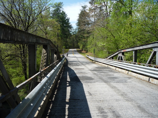
I am not enjoying the ride nearly as much at this point.  Nevertheless, I stop at one of the picturesque places on the DAR campus, to view the Flat Shoals River from the bridge over it.  

I make my way to the river bridge for some pictures.


The view from the other side. 
Well, that is certainly a nice view of the river here.  I feel a little less tense, frustrated, and angry, having looked it over.  

Here are some pictures taken in November of 2009 of the buildings and sculpture on the campus.  


A nice place for kids, certainly.  


...but I still need to make a stop someplace.  

There are several man-made lakes in the Upstate of South Carolina, with almost unlimited opportunities to enjoy the water from the shore, from a boat, or even as a SCUBA diver.   

There are two nearby places to launch boats onto Lake Keowee (and that have rest rooms): Falls Creek Access Area, on Landing Road near 162 Fall Creek Church Road, Salem, SC 29676, and Fall Creek Access Area, directly to the east from 595 Shallowford Road (State Rd S-37-44), Salem, SC 29676. 

I decide to go to the first one.  As I near the turnoff, I spot the signs. 


Ahh.  Relief, soon.  

But wait.  What are those red tinged signs?   They look familiar, for some reason. 


...and what is that block of concrete there for? 


...and this sign in the road. 


...and more blocks of concrete. 


Oh, no.  Now what'll I do?

I stop for a few seconds, then dismount, walk through an opening at the end of the giant concrete blocks, and find the nearest natural restroom.

Relief, at last.

I get out my lunch and a bottle of water and eat in peace, there where no one was likely to come.  As I walk about, I take a better look at the red-edged signs.


Temporarily closed, eh?

This closure surely doesn't look temporary to me, what with the concrete blocks and the ROAD CLOSED sign embedded in the pavement.  I had gone into the forbidden zone, risking life and limb, apparently.

When I am sated, I pack up my tank bag, and go a mile or so to the other boat launch, the one to the east on  Shallowford Road.  I fully expect that I will find the same thing.

To my surprise, I find this:


An empty parking lot.  There is one pickup truck with an empty boat trailer and a single car.

The ramp is open with no warning signs in sight.


This must be a (the?) safe place in the park system.  I feel as though I can breathe freely here.  If someone had come along, I might even have risked getting less than 6 feet from him.

What freedom!  Right here in South Carolina -- at a park no less.

I spend a few more minutes savoring the view, the clean air, the beautiful sky, then start my motor and meander my way back home.   


I really did enjoy my time out, but the unreasonable restrictions are disappointing, unnecessary, and stupid. 

We have lost many of our freedoms in the just the last four or five weeks.  Our economic system has suffered a devastating blow because of mandatory closures.  The news people mostly support our downfall.


The leftists have succeeded in causing us deep distress that we may never recover from. 

...all in the name of protecting us from what amounts to the common cold. 


Maybe the next thing they'll take away is our scooters -- since they have no practical or necessary benefit in the eyes of the leftist bureaucrats. 


.

Saturday, February 8, 2020

A Glimpse of Fall on a Winter Day

.
The weather in South Carolina has been mild for the most part this winter.  Riding a motorcycle here is quite the treat, since you can ride almost all year long.  The roads are not in great condition, thanks to our politicians' graft and corruption, but the climate is just about ideal.

The scenery is nice too.  We live in the Piedmont -- which means the foot of the mountain; the Blue Ridge Escarpment -- so there are some nice hills and twisty roads winding through them.

In the fall, I took a short ride up to Whitewater Falls in the Jocassee Gorge area, just into North Carolina on SC-130.  It is one of my favorite destinations, as you can tell if you have followed this blog for any time at all.  The roads are good, the curves are somewhat challenging, and the falls are picturesque.

The pictures along the road show the fall colors well.  Those colors were to be gone just a few days afterward, and they will not return again for several months.

Here are some highlights.


This fellow coming the other way reached our so far that I almost could have touched him if I had been a little further to the left in my lane.  
 He seemed particularly enthusiastic about his ride that day.  It was an ideal time to be out on two wheels. 


Since that ride of just over a hundred miles back in early November, those leaves have fallen, but the temperatures have been very warm on many days -- sometimes into the mid 60s!  I have ridden quite a bit since then.

Unfortunately, there has been a great deal of rain in January and early February, and now the temperatures have taken a dramatic turn downward.

Take a look at today.


We don't often get snow, but it is now 32 degrees and the low is to be about 28 tonight.

No riding for a few days, I'm afraid.  

.

Saturday, July 20, 2019

Moon Landing and Motorcycling

.
On July 20, 1969, that is 50 years ago today, a United States Apollo spacecraft landed in the Sea of Tranquility on the moon's surface. Six hours later, for the first time in human history, two human beings, Neil Armstrong and Buzz Aldrin, stood on the surface of another heavenly body besides earth.


I saw it live on TV.  It was a once-in-a-lifetime experience.

A lot changed at that moment. Man was seemingly capable of doing anything he put is mind to. Technology made space travel possible, and the offshoots of that effort have benefited all of mankind. 

Consider that the first moon landing occurred a mere 12 years after the Soviets launched the first artificial orbiting satellite, Sputnik. That is an amazingly short period of time for so complex a project. 


So, what did we gain from the Apollo moon program besides some 850 pounds of rock and soil? 


There is a dizzying array of products that use technologies or materials originally developed for the space program.  We'll make a list later on.

What we learned about the moon -- and the Earth and solar system -- is still being sifted through so it can be understood.

One of the profoundly significant tangible objects we got from the moon landing and the Apollo program may well have been those photos that show what the Earth looks like from the lunar surface.

According to Andrew Chaikin, author of several space and science books, including 'A Man on the Moon,' the basis for the HBO miniseries "From the Earth to the Moon," and 'Voices From the Moon,' quoted in Las Vegas Review-Journal, "There was an incredible leap in awareness that we got from looking homeward from all that distance and seeing the Earth as a precious and tiny oasis of life in the vastness of space."

"That is a very profound shift in perspective that Apollo gave us....  Earth is a world to be cherished and protected."

Bishop Dan Edwards of the Episcopal Diocese of Nevada, also quoted in the Las Vegas Review-Journal, agrees, likening those Apollo-era photos to "a God’s-eye view of the Earth and humanity. And from that perspective, we were able to see that we really are all one planet and one intricately connected ecosystem."

Wow!  The earth is a special place among the heavenly bodies.  It is the only place where man can live because of a delicate balance of the earth's atmosphere, light, temperature, plant and animal life.  ...and of course, it is just that -- a place created in the right way by God for mankind to live here. 

Back to the Apollo space program.  Here is a list of spinoffs from Apollo, taken, in part, from The UK Telegraph:
  • CAT scanner: this cancer-detecting technology was first used to find imperfections in spaceship components. 
  • Computer microchip: modern microchips descend from integrated circuits used in the Apollo Guidance Computer.  (Most modern motorcycles have electronic engine controls containing integrated circuits.) 
  • Cordless tools: power drills and vacuum cleaners use technology designed to drill for moon samples.  (All the better to work on those motorcycles of ours without being tethered to an electrical outlet.) 
  • Ear thermometer: a camera-like lens that detects infrared energy we feel as heat was originally used to monitor the birth of stars. 
  • Photography: multispectral terrain photography that uses combinations of different types of light, such as infrared and ultraviolet, reveal things not seen when using only visible light, like diseased trees or crops. 
  • Freeze-dried food: this reduces food weight and increases shelf life without sacrificing nutritional value.
    Insulation: home insulation uses reflective material that protects spacecraft from radiation. 
  • Invisible braces: teeth-straightening is less embarrassing thanks to transparent ceramic brace brackets made from spacecraft materials. 
  • Joystick: this computer gaming device was first used on the Apollo Lunar Rover. 
  • Memory foam: created for aircraft seats to soften landing, this foam, which returns to its original shape, is found in mattresses and shock absorbing helmets.  (Ah, another motorcycle benefit!) 
  • Satellite television: technology used to fix errors in spacecraft signals helps reduce scrambled pictures and sound in satellite television signals. 
  • Scratch resistant lenses: astronaut helmet visor coating makes our spectacles ten times more scratch resistant.  (Another spinoff.) 
  • Shoe insoles: athletic shoe companies adapted space boot designs to lessen impact by adding spring and ventilation. 
  • Smoke detector: NASA invented the first adjustable smoke detector with sensitivity levels to prevent false alarms. 
  • Swimsuit: NASA used the same principles that reduce drag in space to help create the world’s fastest swimsuit for Speedo, rejected by some professionals for giving an unfair advantage. 
  • Water filter: domestic versions borrow a technique NASA pioneered to kill bacteria in water taken into space. 
  • Fire fighting: fire-resistant materials used in firefighting.  
  • Global positioning devices.  (Still another indispensable spinoff we use on our bikes.) 
  • Electrical, hydraulic, and other systems: high-reliability for space applications.  
  • Materials: developed for severe space applications.  
Here is one benefit I'll bet most of us don't realize:  
  • Geo-Political: The United States had beaten the Soviets to the moon. The Soviet government had an aggressive space program, but the superiority of the United States' program resulted in a call for democratization of the USSR, specifically citing the American moon landing as evidence of the superiority of our representative democracy.  (We are more free than any place in the world -- free to ride those bikes of ours anywhere we choose.) 
Think of that! Landing on the moon affected the world's thinking about the best type of government.  Our form of government, where the people, not a small group of dictatorial leaders run the country, is superior to any other. 

The Apollo program affected us in another way:
  • There was a whole generation of kids who began to think about careers in science and engineering.  (Maybe even in motorcycle engineering.) 
Thousands of industries and hundreds of thousands of technically-oriented people have benefited from this spinoff of the space program.

So if I look at the list above, which most certainly is not exhaustive, I see the foam for helmets and shoes, GPS systems, computer microchips, cordless tools for working on our bikes, and the effect on the number of young people going into engineering to develop even more sophisticated and useful products. 

Our freedom, however, is perhaps the most significant of any. 

So, look up before you go out riding next time, and think of all the benefits the space program has generated for us. 

Apollo 11 crew -- Neil Armstrong, Michael Collins, and Buzz Aldrin


References:


.
.

Monday, May 27, 2019

Memorial Day Rememberance

.
Flags  

Your grandma might have called it Decoration Day.  It was called Decoration Day because, in the immediate aftermath of the American Civil War, it was a day when the graves of soldiers were decorated in remembrance of their ultimate sacrifice while serving their country.

We call it Memorial Day now.  That name was first used in 1882, but it did not become common until after World War II, and was not declared to be the official name of the day by Federal law until 1967. 

(Memorial Day is not to be confused with Veterans Day, also known as Armistice Day.  Memorial Day is a day of remembering the men and women who died while serving, while Veterans Day celebrates the service of all military personnel not currently serving.  
Armed Forces Day is a holiday to honor servicemen who are presently in the military.) 

We are not so thankful for their sacrifices these days, I think, but we certainly ought to be.  Our very freedom in these United States was won by -- and is defended daily by -- the blood of our servicemen and women. 

In fact, our young people used to aspire to serve our country, like in this cartoon from around the year 1900. 


 "On Decoration Day" Political cartoon.
Caption: "You bet I'm goin' to be a soldier, too, like my Uncle David, when I grow up."

I wonder how many young people now even know they can serve. 

Why not take a little ride today and decorate the grave of some soldier, known to you or not?

.
.

Wednesday, April 3, 2019

First Glimpse of New Sassafras Mountain Observation Platform -- and a Bit of a Harangue

.
If you have been following this blog for a while, you probably have seen that I have been to Sassafras Mountain -- the highest point in South Carolina -- quite often.  That is because it is not far from home -- about 28 miles, and because it has a few challenging curves in the roads leading to the top.  Interestingly, most of those curves are down on US-178 between Pickens and Rocky Bottom, not near the summit of the mountain.  Once you get to Rocky Bottom, turn right onto F. vanClayton Road, just past the entrance to the Rocky Bottom Retreat and Conference Center of The Blind.  Watch for one unmarked left hand hairpin on F. vanClayton. 

Here is the route from Easley, where I live, to the summit of Sassafras Mountain:

Click here for interactive map.

It is a nice place to ride to and a nice place to see the world from, being the highest point around. 

I have kept up to date on the features of the mountain top over my ten or so years of riding.  At first, there was nothing at the top but a gravel parking lot.  There was no place to see into the distance whatsoever. I'll admit, that was a bit disappointing.  The road was potholed and rough, too.  There weren't many people who visited there as a result. 

A rustic platform was built and some trees cleared about eight years ago to give a nice view to the south and southeast.  Mountains and lakes were made nicely visible, and the platform was sturdy and unobtrusive, made, in part, of forest materials. That view from the platform made the trip to the top well worthwhile.  In fact, the place was ideal: remote feeling yet nearby, and quite beautiful.  The Palmetto Trail passes over the summit of the mountain on its way to the seashore, so you can walk a little ways -- or much further -- if you are so inclined. 

Beginning of Harangue

Then Clemson University graduate students in architecture and landscape architecture apparently decided that they should design and build a new platform, so they demolished the nice rustic one, and built a monstrosity out of mild steel and wood, poorly supported and rickety.  The steel parts are a mass of rust and have become bent by people standing on them.  The students did not properly take into account the abuse from people and weather that public structures receive.  I would certainly not want my life to be dependent on a structure they designed.  After I wrote to them about the poor structural integrity, they reinforced it with some steel cables, but the cables are installed improperly and did not correct the wobble problem.  Dan Harding, Clemson associate professor of architecture, spent our tax dollars for this thing and says that the platform "employ[s] best practices associated with sustainable construction and resource management."  From the looks of it now, it may be a pile of rusted wreckage soon.

Here is a picture of the end of the platform with the beautiful view beyond.


Fortunately, a bit later, the top of the mountain was cleared of scrubby trees so the visitor to the top has a 360 degree view from there. 

They also repaved the road to the top so it is nice and smooth.  That should have been where they stopped.  

Nevertheless, the "improvers" soldiered onward and decided to erect an observation platform at the top and some pit toilets at the parking area.  The contractor, Lazer Construction of Anderson, started in November of 2017 and isn't finished with the $1.1 million project yet.  It was supposed to be finished by May 2018, so it is coming up on a year late -- and a year without having full enjoyment of this special place. 

So efficient. 

End of Harangue (mostly)

Here is a photograph of the structure during construction.


There was a superintendent stationed at the construction site, so you could get fined by the Game Warden if you ventured up there.  (I didn't chance it.  That is someone else's pic above.) 

Here are some other pictures of the ramp leading to the new platform:

The original gravel parking lot is to the left.


The gate at the bottom was open and no one seemed to mind, so I rode up about half way to the platform from the gravel lot.  There is a nice concrete ramp and neatly-graded gravel elsewhere.  It looks as though the view will be nice from the top. 

There is a new gravel trail from the parking lot to the top as well.  It is a way to get there on foot without using the concrete ramp and without bushwhacking through the woods.


They put in a large new directional sign, too, down in the gravel lot.  The old one was a target for guys with shotguns and for large trucks turning.


The sign directs hikers to Table Rock State Park, Caesars Head State Park (more about that in a minute), and Chimney Top Gap.  I see they put a big rock between the sign and the road now to help protect it from errant vehicles. 

I wonder if they are going to do anything to prevent vandalism and traffic tie ups now that they are taking away our quiet place of respite and replacing it with more of a tourist attraction. Vandals may find this dark place to be ideal for their graffiti, and for using alcohol and drugs.  Some will use it as a place for their assignations, I suppose. 

...and the improvers won't be satisfied, even when the present construction is complete.  Phase two of the Sassafras project, which will require additional funding, is scheduled to include a picnic area, accessory trails, informational kiosks, and improvements to the old parking lot.

Well, I think I'll just have to enjoy it until they further "improve" it.  Then, we'll see. 

Anyway, I went back down the mountain to Glady Fork Road and turned right.  This road meanders to the north, in places along a river.  If you keep your eyes peeled there are some small waterfalls along the right side of the road.  There are no guardrails and the road surface is quite rough, but the ride is good enough to recommend.  At the end of Glady Fork, I turn sharply right onto East Fork Road.

After a few miles, don't miss the interesting vehicles and animals poised in a yard on the left side of the road.  And Big Hill looms ahead and requires you to negotiate a couple of tight curves as you go up.  Fun, and usually free of loose gravel.  Watch for drivers coming down the hill on the wrong side, however.

I follow east Fork to Greenville Highway, US-276, and turn right.  There are some rather straight sections through here and a few nice sweepers.  Dupont Forest (watch for the sign) is to the left as is Green River Road, a partly gravel route I have taken before.

Near the summit, lies Caesars Head State Park.  I pull in for a little rest and a quick look over the Blue Ridge Escarpment -- a drop of about 1000 feet here.


Once I have seen it all (!?), I continue to the south, down quite a few tight turns, until I get to SC-11.  From there it is a quick ride home over gently curving roads. 

Here is a map of the entire ride today, only about 75 miles:  

Click here for an interactive map.
Well, to recap today, I learned about the new Sassafras construction, and got to see the world from two high places.

Despite my harangue about the work on Sassafras, it was a good day to be out.
.
.
.