Showing posts with label Pisgah Astronomical Research Institute. Show all posts

Saturday, July 18, 2015

50,000 Miles

.
I predicted that this would occur on August 30, 2015.


It actually happened a little before that, on July 13, at 9:46 AM, to be exact.

For those of you who don't know, I started riding a motorcycle in late 2007, at the then youthful age of 57.  I had been thinking about it for a long time, and finally asked a colleague at work whether he thought I could learn to ride.  He gave me the encouragement.  Thank you, Jeff

I took the MSF Basic Riders Class, bought an almost new motorcycle, and set out to learn how to ride it.


Along the way, I have met people I would otherwise not have met.  A few of them have helped me with my riding technique.  I thank you for that, Ryan, especially. 

I had some success learning to ride the bike, with a few failures here and there.


I have gone places I otherwise might not have. Some of those places are chronicled here in this blog of mine, along with the progression of learning how to ride, and a few other topics that interest me and maybe you, too. 

I have, at times, been frustrated by my slow uptake on some riding techniques, and I will never be a highly-skilled rider capable of breathtaking speeds on twisty roads. Nevertheless, I have had some good times on it. 


I still have that same motorcycle, the only one I have ever owned, a 2006 Kawasaki Ninja 650R.  

Well, except for this little guy that I built with my brother and rode as a teenager. 

Licensed for street use, I might point out.

I never thought it would come this far, but I have now ridden my Ninja   

....50,000 miles!....

Yes!
(The bike has a few more miles on it than that, since I bought it used, so that is how far I have ridden it.) 


Just how far is 50,000 miles?

Well, lets compare that to circumnavigating the earth.  (If you consult the nearest globe you will find that there is actually some water in the way of doing this, in places.)  The circumference of the earth at the equator is 24,901.55 miles (40,075.16 kilometers). 

So, I have ridden a little more than twice that far. 


How about the distance to the moon?  The average distance to the moon is 238,855 miles (384,400 km). 

So I have gone about 20% of the way to the moon. 


How about some other statistics? 

I have had the bike out of the garage 633 times, and have averaged 6400 miles per year.  That average should be going up now that I am riding more often since my retirement from the job. 


Where did this auspicious milestone occur?

The 50,000 mile mark occurred on a very twisty road northwest of Rosman, NC. Silversteen Road is a two lane with good surface and very little traffic.  I wrote about it some time back.  There are lots of twisty roads around there. Watch for a little gravel and sand in places by scouting it out on your first pass, then repeating traverses to your heart's content. 

The exact place of the achievement was at Silversteen and Diamond Creek Road. 

(No, I didn't try to tear down the street sign to take it home.)
Right here on the map: 


This occurred during a short 106-mile ride that continued on to the Pisgah Astronomical Research Institute, or PARI for short.  I have been there before, but it is still a very unexpected and interesting place -- a spacecraft tracking station, later a satellite intelligence gathering station. 

This is what you see when you first enter the complex, an 85 foot diameter dish, one of two that are identical here. 


Here is the other one, with a smiling friend nearby. 


The smaller dish with the smiley face was painted that way when the station became a satellite intelligence station.  You see, they were tracking and intercepting data from satellites including those of Russia.  They knew the foreign satellites were photographing the site.  They painted the face so the Russians had something to look at.  The little dish is now controlled from the Internet so students anywhere can direct it. 

Read more about PARI here, and here, and here


How has the motorcycle performed, Bucky?

The only troubles from the motorcycle have been the fuel pump failure and water pump coolant and oil seal leakage.  Major maintenance has been a couple of chains, a set of sprockets, brake pads, valve clearance adjustment, and five sets of tires.  I'd say it has been relatively trouble free.  It still runs like a top.  

In operation, it can do way more than my brain will allow my body to do with it when I'm riding.  For a relatively inexpensive bike, it has great performance capabilities, while being much more forgiving of ham-handed throttle twisting than a 600 or 1000 cc race bike.  The ergonomics are good enough that an older rider like me can ride it comfortably for 80 or 100 miles before a break. 

Is the bike used up?  I don't think so.  There are several guys online who have ridden their similar bikes upwards of 100,000 miles (160,934 km). 


Previous milestones:

What's next?
Well, I still enjoy riding, so I will probably keep it up for a while.  Some of my friends encourage me to look at a cruiser next, since I am getting so "up in age," according to them.  (Funny, I haven't noticed that.) 

I'll keep on writing here as interesting things come to mind, especially landmarks and good roads. 


Here is my entire route today, along with a blowup of the twistiest parts: 

The 50,000 mile mark was hit at location 2 on the map above.  PARI is at location 3. 

See you on the [hopefully long] road ahead. 
.
.

miles ridden miles i have ridden motorcycle mileage miles i have ridden the motorcycle miles i have ridden this motorcycle miles i have ridden the bike miles i have ridden the scooter mileage record mileage thread
how far have you ridden distance I have ridden the motorcycle distance i have ridden this motorcycle distance i have ridden the bike distance you have ridden the scooter distance you have ridden the motorcycle distance you have ridden this motorcycle  distance you have ridden the bike distance you have ridden the scooter

Sunday, May 4, 2014

Ridiculously Twisty

.
Several years ago, a local rider, the tall fellow Stretch, posted on one of the on-line forums about a "Ridiculously Twisty" road that runs between NC-215 and NC-281.  He has probably ridden most of the roads in the upstate of South Carolina, Western North Carolina, northern Georgia, and well beyond.  He recently switched to a dualsport, so he is probably doing the same on all the gravel and dirt in the area too. 

Anyway, with the end of winter, and the advent of clean pavement without a lot of gravel and sand left over from the ice and snow that sometimes attacks the mountains around here, I finally decided to find the likely road, since he didn't identify it back then.

Google maps is my friend, so I started to explore.  I came up with several possibilities.
  • Charleys Creek Road/NC-1756, Neddy Mountain Road/NC-1757
  • Wolf Mountain Road/Tanasee Gap Road /Joe House Road/NC-1324
  • Silverstein Road/NC-1309
This is the route I mapped out, that might include the Ridiculously Twisty road.
Click here for an interactive map and route details. 

From home, I go first to Pickens, SC.  The road north from here is US-178, and the section between Pickens and SC-11 is mostly sweepers.  I enjoy this part of the road because it is usually clean, isn't too difficult, and it contains A Perfect Curve.

North of SC-11, the location of a biker meetup place, the Holly Springs Country Store, the road becomes much more technical, with many tight turns, and lots of elevation change.  You need to use your best look-where-you-want-to-go technique here.  This part of the route ends at Rosman, NC, but there is an even better road that starts here.  It is NC-215, recently paved, and with lots of tight curves as well.  I have used this route many times to get to the Blue Ridge Parkway, only 51 miles from home. 

Today, though, I turn left onto Charleys Creek Road, at Pushpin B on the map above.  I have not been on this road before, and almost right away, the road begins to show itself as ridiculously twisty, and keeps it up to its end, at Pushpin C.  The pavement is broken in places, there are a few patches of gravel and sand, and some of the curves are very tight.  Naturally, this being a rural route, there are no speed advisory signs, so you are on your own.  There are some Christmas tree farms and other nursery operations, but not much else through here.  I ride moderately, enjoying the trip through the hills. 

I turn south on Canada Road NC-281/NC-1758, for a few miles, an enjoyable road with some interesting curves, eventually passing over the T. Fields Dam on Wolf Creek, where I have stopped before.  I take a break, then continue on to Wolf Mountain Road/Tanasee Gap Road /Joe House Road, at Pushpin D.  This road is a bit twisty in places, but not a much as Charleys Creek Road was. The surrounding hills are still enjoyable to look at. 

I have seen quite a few bicyclists out today.  There must be an organized ride.

Why a lot of them insist on taking up the whole lane on a twisty road, I don't know, though. 

There is a pack of them at Pushpin D who run the stop sign there just as I am arriving.  Two of them, the one on the black bike and the one following him, almost bite the dust as they see the error of their way too late and turn in front of me.

Fortunately, I miss them. 

Pressley Fields Road takes me back to NC-215, then on to Macedonia Church Road.  I turn into the Pisgah Astronomical Research Institute (PARI).  I am surprised that the gate is open on a Saturday.

This is the former spy satellite tracking station, turned education facility.  It is truly an unexpected sight here in the mountains of North Carolina, and it was an important, top secret tool in the cold war.  They are having a once-a-year open house today.

I wish I could stay, but I have been here before, and I must move on today, because I have chores to do at home. 

The last twisty road nearby (besides US-178 that I will be using to get back home) is Silversteen Road.  This is a very twisty route that some say rivals the Tail of the Dragon.  It is far less busy than the Dragon, and quite entertaining.  Watch what you are doing, however, because it is not well marked for the turns either.  I have ridden this one before as well -- seven passes on one day.  (I couldn't help myself.  It was great fun.)

I meet this group of BMW riders, booking it through the Silversteen turns.

They're having fun too, it looks like.

Silversteen ends at US-64 not far west of Rosman.  I go back into Rosman, and head down US-178 again to Pickens, retracing my route, now from the opposite direction.  Downhill is a bit more challenging, but I make it through just fine.

I think I found Stretch's ridiculuously twisty road today -- and then some.

I have ridden only 138  miles, but, boy, those roads were sure contorted!  Try my route some time, and let me know what you think. 
.
.

Thursday, December 8, 2011

PARI, Placed in Perspective

.
Way back in April of 2009, just when I had reached 10,000 miles on my bike, I wrote about visiting the Pisgah Astronomical Research Institute, or PARI for short.  This impressive facility is located only a little over forty miles from home, but it is truly out of this world in appearance.

If you remember, as quoted from the PARI website:
"The facility, then called the Rosman Research Station, was a NASA site used during the 1960s and 1970s for tracking manned and unmanned space flights. It was the nation’s primary east coast satellite-tracking facility. In 1981, the facility was transferred to the Department of Defense for use as an intelligence gathering facility for U.S. defense and satellite communications. In 1995, the Department of Defense closed the facility, and turned the site over to the U.S. Forest Service.

"In 1999, the site was purchased from the U.S. Forest Service and given to PARI for use as an astronomical research and educational facility."
PARI hosts homeschool days, public tours on Wednesday afternoons, and Evenings at PARI held once a month to hear about and view the Heavens.

Anyway, I was riding on Saturday November 5 up NC-215 north of Rosman North Carolina on the way to somewhere else, when I turned down Macedonia Church Road toward PARI on a whim.  The facility is usually closed on Saturdays, so I really didn't expect to be able to go in.  I was surprised to see that the gates were open, so I went on in.

As it turns out, the site was hosting TEDxKatuah: The Art of Discovery.

For you who are not well informed, the TED website says that TED and Katuah are: 

...a nonprofit organization devoted to Ideas Worth Spreading.

Katuah is a name often used to reference the bioregion that includes the mountain areas of North Carolina, South Carolina, Tennessee, southwestern Virginia and northern Georgia.  A bioregion is defined by physical, environmental, and cultural features, which mirrors the interdisciplinary nature of this event, TEDxKatuah. 

It is said that the word “Katuah” was adopted from a Cherokee name for the mother town, Kituwah or Kituhwa. Although the exact origins surrounding the use of Katuah as a name for the bioregion are murky, the name may have been coined by Peter Berg and Raymond Dasmann in the 1970s.
Oh.   Now we know. 

The event was organized by TEDxAsheville and featured speakers, exhibits, performances and interactive events.

Well, I had blundered into the middle of it, and was rubbernecking the big dishes and other things around.  I didn't stay, though they invited me provided I register, but I did snap a couple of pictures to give you an idea of the magnitude of one of the two largest dishes on the property.

Front view.

Rear view. 
This dish has a diameter of eighty-five feet.  BIG. 

Makes me feel small.  Just think of what this dish may have seen through its electronic eye while looking heavenward.  

Go visit some time.  For five bucks, they will give you a great two-hour tour. 

.

 .

Saturday, April 11, 2009

More About Pisgah Astronomical Research Institute (PARI)


.
A few days ago, I posted about my visit to the Pisgah Astronomical Research Institute [PARI] north of here. This is some more information about that trip.


The PARI tour for the general public is every Wednesday at 2:00 PM. I took the day off and started out earlier than I needed to, so I had some time to kill -- riding, of course!


View Larger Map

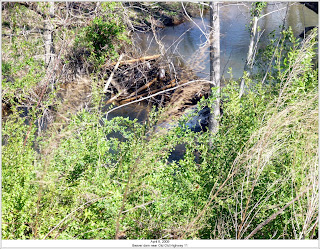
I enjoy going north on SC-135, so I start out that way. I turn right on SC-186, ride through Dacusville, then US-276 to Marietta, and Cleveland, SC. I turn left on SC-11 and ride to a side road whose name catches my eye: "OLD OLD HWY 11." Hmmm. It must be really, really old! Rather, I think the meaning is that Highway 11 has been relocated twice, resulting in Old Hwy 11 becoming Old Old Hwy 11. I'll have to do some research on this. There are the remains of a building on the corner, evidenced only by a standing chimney with a first floor and a second floor fireplace opening. There is also a stream across the road with a beaver dam visible from the road.




A little further on, I come to Wildcat Branch falls. You don't even have to dismount to see the lower falls. All you have to do is stop and look. The name of the falls is not marked, but there is a wide paved parking area on the north side of the road.


View Larger Map

There is also an upper falls that is a short walk up the hill and the remains -- only the fireplace and chimney -- of a cabin that once was there.


While I am stopped, I can see Table Rock, so I take its portrait.


And a closer up view.


After a few minutes, I continue on a few more miles to the Table Rock visitor center, a favorite place to stop and rest, hydrate, and see the scenery. Recall that the view of Table Rock is very good from this vantage point, as is Lake Oolenoy. The ranger there also points out Pinnacle Mountain to me, the highest peak entirely within South Carolina.


There is a higher peak, Sassafras Mountain not far away, but part of it is in North Carolina.

Some low-growing flowers in bloom.


Azalea.


Tulips.


All right, all right, cut the comments about the softer side of Bucky. You have to agree that the flowers are pretty to look at.

Once I leave Table Rock, I go further along SC-11 to the Holly Springs Store. I usually stop there to see if there are other bikers about. Today there are two. Tim, riding a vintage Honda V-twin, and one other fellow.


I chat with Tim a bit about his bike. He says the bike was in good original condition, but he has done considerable cosmetic work, and some mechanical work to get it into the fine shape it is. The only thing that he says had been repainted is the fuel tank. He speaks proudly about how well it came out and his joy in riding it now that it looks and runs almost like new. Good work, Tim.

Tim is on his way to a family gathering, so he doesn't have an answer to my query about the road condition into the mountains on US-178. Neither does the other rider who is having breakfast. Oh well, I'll just have to find out for myself whether there is any sand or washed gravel on the road.

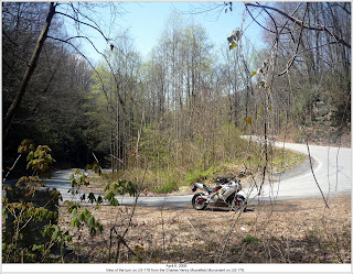
It turns out that there is neither. I take it easy, though nonetheless. I don't want to wreck. One of the particularly tight turns just before entering North Carolina has a stone monument to Charles Henry Moorefield, a South Carolina state highway engineer between 1920 and 1935, who probably had a part in designing this road. It must certainly have been a task. Look again at a closeup of the route up the Blue Ridge Escarpment.


View Larger Map


I reach Rosman, NC and stop for a drink of water and to rest for a few minutes. PARI is only a few more miles, so I have a little extra time.

Once rested, I continue to US-64, turn left, then turn right on NC-215 where Headwaters Outfitters is located. They do canoe, kayak, and tubing trips on the French Broad River and have a store here.

NC-215 is the route that also goes up to meet the Blue Ridge Parkway about fifteen miles north of US-64, a great place to ride that I will report on in future. Today, however, I am going just six miles to a side road called Macedonia Church Road. The driveway for PARI is off this road.


I stop at the entrance and take note of this sign.


I ponder it for a minute, but conclude that I must have missed my engraved invitation in the mail. Actually, their Wednesday tours are well-publicized on the Internet. I go past both the sign and an unmanned guardhouse. A sign at the guardhouse says to park by the flagpole. I wander along for a few hundred yards gawking at the two huge telescope dishes and the many buildings before I find the flagpole. It is better that I look around while on foot: It is too easy to steer off the road when on the bike with such interesting stuff around. I park, take off my gloves and helmet, pull off my tank bag, set my alarm, and go in.


A young astronomer near the entrance.


They charge a whopping five dollars for a tour. I open my wallet to retrieve some cash. By the way, my "wallet" is a zip-lock bag that I use to keep my money and identification in when I ride. That keeps the documents and what little money there is from getting soggy with sweat (sorry to bring it up, but sweat does happen) and from rain.

I take off my jacket, armored shirt, and sweatshirt and stow them with my tank bag near the front desk. I meet a pleasant woman at the desk who, it turns out, will be one of our guides today. The official designation on her badge is docent, which means a "volunteer trained to give educational tours to visitors." I join the small tour group of four others in a multimedia room for an introductory movie. It describes the history and current use of the site. It started out as NASA satellite tracking station, then was used for cold war listening in on overflying spy satellites, and is now used for research and education.

The docents today are Bobbie and John. Bobbie, the woman at the front desk and a former employee of the NASA tracking station in its (and her) earlier days, was later a college science teacher at nearby Brevard College and elsewhere. John is a retired electrical engineer. Both are very knowledgeable and articulate, and were eager to answer our questions.

We are allowed to take pictures of anything we see. It makes me feel like I am a privileged visitor to a secret spy installation. And so I am that -- just a few years too late!

These two small buildings were used for high-level briefings during the satellite monitoring period at PARI. Officials would disembark from their vehicles under the canopy and walk beneath it to the buildings, so spy satellites could not identify them.


PARI is a great place to visit, but an even better place to learn about astronomy, physics, and other disciplines. They offer classes for kindergarten through post-graduate students.

There are many radio telescopes there including two with a dish diameter of twenty-six meters (eighty-five feet).


Above photo is from the PARI website.

These are not the largest such dishes, but they are quite impressive, especially up close. They can point in any direction down to the horizon of the bowl-shaped PARI site. They were once positioned by hydraulic drives for control and speed. Remember that a satellite directly overhead can have considerable velocity and the dish must keep up with it. Today, the hydraulic drives have been replaced with electric drives. These are suited for the current use of the dishes but are much slower in positioning capability.

There are many more radio and optical telescopes around too, some of which can be controlled and monitored by students over the Internet. The surroundings are also ideal for optical telescope viewing of the Heavens as it is quite far away from artificial lighting sources.


Above photo is from the PARI website.


Above photo is from the Wikipedia website.

One educational program for students involves their building a radio receiver -- nicknamed JOVE, a name for Jupitor -- in the 20.1 MHz range that connects to the audio card of a computer to display the received waves, mostly from the planet Jupiter and from the sun.


JOVE receiving antennas: Wire dipoles.


Another project for students is building an optical telescope using an eyepiece and objective lens held in position by sections of PVC pipe. This makes for an inexpensive, but functional and fairly rugged telescope.


We walk through an underground passage that comes out near one of the large dishes. The passage contains all of the control and data cables for the dish. John quips that this is the self-guided portion of the tour -- we couldn't go wrong here anyway, since there is only one way to go.

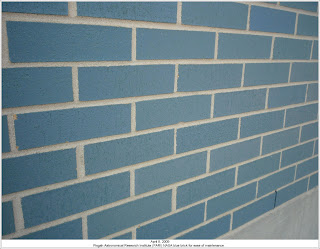
Once we emerge from the tunnel, I ask about the blue glazed brick evident on the exteriors of many of the buildings. John tells us that the brick is NASA blue, and was specified so that the buildings did not have to painted, and did not require periodic maintenance.


Some more information from the PARI website:
"The facility, then called the Rosman Research Station, was a NASA site used during the 1960s and 1970s for tracking manned and unmanned space flights. It was the nation’s primary east coast satellite-tracking facility. In 1981, the facility was transferred to the Department of Defense for use as an intelligence gathering facility for U.S. defense and satellite communications. In 1995, the Department of Defense closed the facility, and turned the site over to the U.S. Forest Service.

"In 1999, the site was purchased from the U.S. Forest Service and given to PARI for use as an astronomical research and educational facility.

"A key man who had the vision to start the institute was J. Donald Cline. He was born in Statesville, NC, and has lived in the state most of his life. He has lived in Greensboro since 1959 when he joined the technical staff of Bell Telephone Laboratories. In 1977, Don left Bell Labs with three other engineers and formed Micro Computer Systems (MCS). Following the sale of MCS to Harris Corporation in 1995, Don served as the president of MCS Operations at Harris for one year.

"In 1998, Don founded the Pisgah Astronomical Research Institute and continues to serve as PARI’s president and board member."

PARI hosts homeschool days, public tours on Wednesday afternoons, and evenings at PARI held once a month to hear about and view the Heavens.


Above photo is from the PARI website.

PARI is also home to the Astronomical Photographic Data Archive (APDA), a site to help preserve some 80,000 astronomical photographic plates. These glass plates were the primary recording medium for astronomy data from the late 1800s until the 1980s. The plates are being scanned into computer files for more rapid access by astronomers around the world. The scanning is done by a very accurate scanner supported by a large precision granite block. The resolution of the scanner is one micron (0.00004 in). It takes about half a day to scan each plate, and they have great banks of hard disk storage space to hold all the data. This will be quite a job!


The tour ends about 4:00 PM, and I linger for a few minutes on the site looking again at the buildings and equipment. It is certainly an interesting place, especially for someone who is a student of astronomy and science. Already, I would like to come back again.

I put on all my gear, mount my bike, and start out for home. It doesn't seem quite as far on the way back. Maybe I am becoming more confident in my riding. Being mostly downhill on NC-215 and US-178, I use the technique of staying in third or fourth gear to control my speed around the turns. It seems to work fairly well, but I find that I still must tell myself at times -- frequently out loud -- not to let off the throttle abruptly, and that a given curve is no problem for me to negotiate. Even though I am getting more accustomed to the twisties, I am certainly not as confident of the bike's abilities as I know I could be.

I reach home safely, having clocked 121 miles on my route today. I have enjoyed my time out riding and sightseeing. ...and passing this milestone I wrote about previously.


Here are some neat photographs from the PARI website:


More information about PARI is available in Wikipedia.

More information about the JOVE receiver is available at The John Burroughs Earth & Space Science Club at State University of New York (SUNY), Ulster County Community College, Stone Ridge, New York, and at the NASA website.
.