Showing posts with label museum. Show all posts

Wednesday, August 19, 2015

Fields of the Wood

.
Ever see anything like this?

See: Exodus 20:2-17

Neither had I until this week.  The weather forecast for the week showed rain, rain, rain, except for Monday.  So, I took the day and went to a pretty neat place up near Murphy North Carolina.

That's where I took the photo above.  The gigantic Ten Commandments are on a hillside at a place called Fields of the Wood Bible Park.  All you have to do is go in and look around.  It is free for the asking.  (More about that later.)

The place covers some 210 acres, and includes dozens of concrete markers with information and inspiration from the Bible.  It is almost as though you are walking through that precious book as you explore here.  The place is a ministry of: the Church of God of Prophecy in Cleveland Tennessee

I found out about it way back in October of 2011 on the Carolina Rider Forum.  The tall guy who used to post quite a bit there, Stretch, had set it as a tag, but nobody went after it for some reason.  


Well, I finally took the time to go there.  Better late than never, I'd say.

It is 256 miles round trip, without diversions.  With diversions, it can be as long as your hind end can stand your saddle, since there are some nice curvy roads there and about. 

[So.  How do you get there, Bucky?]

I took the most direct route, using Harley-Davidson Ride Planner.  (That's the website that works so much better than Google Maps and the one that downloads your custom route directly to your GPS if you want it to.)  I wrote about how it works back in April or 2015.

Here is the route:

Click here for a Bing interactive map

Major towns and road names starting in Easley, SC, on the right side of the map:

  • US-123 S, 34.0 mi
  • Clemson, SC
  • Seneca, SC
  • Westminster, SC
  • Brasstown, SC
  • US-76 W, 25.6 mi
  • Long Creek, SC
  • Enter Georgia
  • Clayton, GA
  • US-23/US-441/US-76, 0.3 mi
  • US-76 W, 31.2 mi
  • Macedonia, GA
  • Hiawassee, GA
  • Hwy 17 N/GA-515 E, 1.1 mi
  • Enter North Carolina
  • Hayesville, NC
  • NC-69 N, 3.5 mi
  • US-64 W, 13.5 mi
  • Murphy, NC
  • US-129 S/US-19 S/US-64 W/US-74 W, 8.0 mi
  • NC-294 W, 9.9 mi

Arrive at Fields of the Wood, 10000 NC-294, Murphy, NC, 28906


There are some nice sweeping curves on the road between Brasstown and Clayton and between Clayton and Macedonia.  There are also some between Hayesville and Murphy.  The rest of the roads are mostly less challenging.  There were almost no areas of less-than-excellent pavement that I saw, and the traffic was light. 

And remember that Deal's Gap, and the Tail of the Dragon are only about 58 miles from Murphy on this route

[What else can I see there at Fields of the Wood?]

Well, here is the entrance:


And the arch just beyond it: 


The arch and the road beyond it:


These things can also be found:


A satellite view:


At the top of the Ten Commandments mountain, is a 30 foot tall open Bible. 


It is open to the passage in Matthew 22:37-39, where Jesus replied [to an expert of the law who was trying to trick him, asking, "Teacher, which is the greatest commandment in the Law?"]: "'Love the Lord your God with all your heart and with all your soul and with all your mind.'  This is the first and greatest commandment.  And the second is like it: 'Love your neighbor as yourself.'  All the Law and the Prophets hang on these two commandments."  A lot of people don't know that there are many more than ten commandments, and these are two of them.

A closer view of the open Bible:  


View from the top of Prayer Mountain, looking through the trees, and across the valley at the Ten Commandments:


It is quite a hike to the top of either Prayer Mountain or the Ten Commandments, but there is a road to get to the top in each case, too.

View from the top of the Ten Commandments, showing Golgotha with the three crosses in the center, the baptismal pool at far left, and Jesus' tomb between the two:


Here is a view from the same vantage point, showing Prayer Mountain just left of center, Psalms of Praise in the center, and a light plane in its shelter at the left: 


The plane was part of a fleet of planes that was used from the 1940s, possibly through the 1960s to distribute Gospel tracts.  It was called the White Angel Fleet, and was based on the airstrip at the site.

Here is an aerial drone tour that takes you through some of the exhibits (without the climbing):


By the way, the free entry -- for the asking -- has some great parallels to the only way you can get to heaven and live forever after you die and leave this earth.  You must believe in your heart of hearts what the following words of the salvation prayer say: 

Dear God in heaven, I come to you in the name of Jesus. I acknowledge to You that I am a sinner, and I am sorry for my sins and the life that I have lived; I need your forgiveness.

I believe that your only begotten Son Jesus Christ shed His precious blood on the cross at Calvary and died for my sins, and I am now willing to turn from my sin.

You said in Your Holy Word, Romans 10:9 that if we confess the Lord our God and believe in our hearts that God raised Jesus from the dead, we shall be saved.

Right now I confess Jesus as the Lord of my soul. With my heart, I believe that God raised Jesus from the dead. This very moment I accept Jesus Christ as my own personal Savior and according to His Word, right now I am saved.

Thank you Jesus for your unlimited grace which has saved me from my sins. I thank you Jesus that your grace never leads to license, but rather it always leads to repentance. Therefore Lord Jesus transform my life so that I may bring glory and honor to you alone and not to myself.

Thank you Jesus for dying for me and giving me eternal life.
Amen.
It is important to note that you don't have to work your way to heaven.  All you have to do is sincerely believe the words above -- it is free for the asking!  Once you do that, then you will want to do good works for others as a result. 


As I am winding down my visit, I notice that the Tennessee state line is a little less than four miles away to the west.  I have only ridden in three states so far -- South Carolina, North Carolina, and Georgia -- so going there would increase my state count by a whopping 33 percent.  I go for it, but I would later regret taking the extra time to dash over there and to try out a few very curvy roads nearby.  


Coming back from Tennessee, it starts sprinkling.  Then it starts to rain.  Then it starts to rain hard.  Then it starts to pour. 


Poor Bucky doesn't have his rainsuit along, either.  There is no choice but to continue. Since I am heading east, I should eventually ride out of it, but it takes an hour and a half to do so.  That's why they call them scattered showers, I believe.  I dry out mostly by the time I pull into my garage.

All together, with my little side excursions, I have ridden 302 miles, my longest single-day ride so far.  Surprisingly, I am not all that tired, even after riding in the rain.  (Maybe the rain invigorated me. Who knows?)  I am a little stiff in the legs the next day, but not bad for an old guy.

I'll tell you about the other curvy roads in a future posting.  Don't miss it. 
.
.
.

Wednesday, January 22, 2014

Jail Time

.

On the way home from a ride in the mountains the other day, I had to spend some time in jail. 

Now, I am sure you'd never have thought that good ‘ol Bucky would wind up behind bars. 

But I did, and here's the view from inside to prove it, looking out through the mesh at my faithful scooter: 


Here’s the story.  

My time in jail started in a portable cage on wheels that was once used to house prisoners overnight while they were working off their debt to humanity, but were working far enough from the jail building to preclude their returning each night to sleep there.  Back in the early 1900s, a responsible municipality could purchase a cell on wheels that would be located near the workplace of the convicts, and give them a warm, dry -- and secure -- place to spend the night.  

The one I was a captive in, made by Manly in Dalton, GA, slept 18 men, and had a place for a warming fire, and canvas sides to keep the wind out and the heat in.  The steel wheels originally had solid rubber tires that are long gone. After the county acquired gasoline powered trucks and machinery in the 1930s the cage was no longer used.

I had to check it out thoroughly.  There was a latch on the outside, so I opened the door, went in, and had a look around. 

It didn't feel much like home, frankly.  

Going into "my" cell:   

I was smart enough not to close the door behind me. Sure as shootin' some neighborhood kid would come by and lock the door with me inside. 

No, I didn't get trapped inside and then have to appeal for help from some benevolent soul passing by. 

It is the old Pickens, SC jail that this cage sits outside of.  It has been turned into a museum of sorts.  After I left my outside cell, I served some time spent some time in the main building, originally built in 1902.  

…not in a cell, mind you… 
 

Anyway, there is only one cell left in the building. This one:

That noose back there was used for the last two public executions in front of the courthouse in Pickens County in the early 20th century. 
 

The jail looked like this in 1908: 
South Carolina Department of Archives and History
The jailer and his family lived in quarters on the west side of the building.  Some of the barred windows today have shadowy silhouettes of bad guys behind them.  

The jail building houses displays of quite a lot of local history from the olden days.   

There are also some exhibits that describe people who have been important from the area, and there are four Congressional Medal of Honor recipients born around here.  Brave men, those, who served above and beyond the call of duty: 

There is almost always a display of artwork as well.  One of the displays right now is by a Greenville artist, Pat Kilburg.  

She does some of her art using a method called encaustic but uses more familiar materials as well. 
Look here:


I confess that I don't understand the round things as subject matter, but suppose some art connoisseurs must. 

A dozen other artists currently have displays here too.  One of their pieces:
This is a serendipitous one called "the Sky is Falling," by Beth Bullman Regula

I don't understand it either, but it is fun to look at. 

Well, luckily they sprung me after I had looked at all of the displays and artwork, I made my way to freedom, hopped onto the saddle, and headed down the road to the comfort of home.  

Oh.  Try not to go to jail for real, please. 
.
.

Monday, March 19, 2012

Back to Belton -- For Some Culture and Maybe a Show

.
Back in September of 2010, I traveled down to a town called Belton South Carolina.  It is about twenty-five miles from home, with easy roads to get there.  They have a huge structure in town called the Belton Standpipe.  Actually, it is a water tower built in the early 20th century.  I wrote about it then. 

Last weekend, I met up with a new friend who rides a 1982 Honda CB450SC Nighthawk, and we rode down there again.  My friend was apologetic for the older machine he was riding, but it was more than up to our little jaunt today. 

The reason for our trip was not only to enjoy some of our unseasonably warm winter weather, but to view an art show.  Sounds very cultured, doesn't it? 

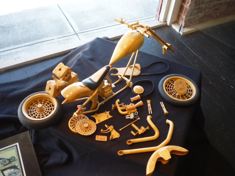
Well, this art show is at the Belton Center for the Arts, and until the end of March, displays only motorcycle-related artwork.   The show is called "Two Wheels, One Journey."  The famous local motorcycle photographer Patrick Welch has four of his photos on display amongst paintings, pastels, carvings, and other media.  Patrick had his photos printed on special paper, and they really stand out from typical prints.  

Here are thumbnails of Mr. Welch's work on display.  You can purchase exact prints of the photos on display from his website.


Some of the other artwork in the show includes these.


The carving on this one is very intricate, and the finish is impeccable. 


There will also be the The Ultimate Bike Show Rally on the Square in Belton on March 24th between 10:00 AM and 3:00 PM. You can enter as a participant or just go and drool. 

Across the street from the art gallery, is the old Southern/Blue Ridge Railroad Depot.  When built in 1910, it served 68 trains and trolleys, but by the 1960's, service to the station ceased.


It now houses a museum with mostly farming artifacts from the area right now.  For you John Deere fans, a 1943 model "LA", advertised to be the equivalent of three horses:
This one is equipped with attachments to furrow, plant, and fertilize in one pass.

The woman who greeted us in the museum, a retired school teacher, asked how we had found it.  We said we had come to view the artwork, which she proceeded to tell us was across the street in the art gallery.  She couldn't get over the fact that we had stumbled in to the museum instead.  She had us sign the guestbook, and she took our pictures, which I am sure will show up in the local newspaper.  Maybe they don't get many visitors.  Anyway, she provided some local interest that added to our visit. 

The South Carolina Tennis Hall of Fame is in the same building, but we were so eager to go get our culture for the day in the art gallery, that we forgot to go in. 

The standpipe is still there, by the way.  See:


The roads leading to and from Belton are well-paved, but rather uninteresting for the most part, good for cruising, I'd say.  There are not many places to pass slower traffic, either.  This is the route we took. 


View Larger Map


On the way back we passed through Anderson -- it was way too busy to enjoy the ride -- but enjoyed a stop at a little park just north of town on Lake Hartwell called Darwin Wright.  It offers swimming, a boat ramp, fishing, and picnicking. We just used the little rider's room, and chewed the fat for a few minutes. 

The day was only about 80 miles, but it was nice to get out on a warm winter day.
.

 .

Monday, October 25, 2010

Road to Nowhere, and a Good Jumping Off Place

.
October 16, 2010, a little more than a week ago. 

I have plans today to nab the current tag in our local tag game.  The weather is supposed to be clear but cool, so it should be ideal.  I think I know where the tag is located, and I intend to go there before anyone else gets it.

The tag is shown in this photo, and the clue follows:
"Here's a real challenge.  Let's see who can find 'no where.'  Well, at least that's where the road is supposed to lead.  You can just make out the 'secret tunnel' a little way past the barricade.  I guess that is a tunnel to nowhere. The pavement ends just the other side of the tunnel. 
The 8 miles prior to this picture is a lot of fun.
A picture of your bike at the barricade wins this tag."

I key in on the "road to nowhere" phrase, and find it on the map, near Bryson City North Carolina. 
It is a little over a hundred miles one way, so I want to get an early start.  I have mapped out the intended route, and find that I have not been on many of the roads.  Some of them appear to be quite twisty.  We'll see how it goes. 


Here is the way I want to go:

View Larger Map


I dress warmly for the ride, as the temperature is about 41 degrees F when I leave.  By the way, since it is getting to be cool weather again, it is good to review the gear I wear when it is cold.  It is in a posting called Dressing for Cold Weather Riding.  Catchy title, eh? 

The first part of the route is through familiar territory.  I head from Easley to Pickens and up a curvy section of US-178.  The Holly Springs Country Store is at the corner where I turn left onto SC-11, the Cherokee Foothills Scenic Highway.  This is an easy two-lane road in very good condition through here.  Most bikers use it to get from one twisty road to another, or for a leisurely, scenic jaunt to a restaurant. 

I turn north again in SC-130.  This is the road to Whitewater Falls and Bad Creek, places I have visited many times.  Before I reach either, however, I turn onto the Wigington Byway, a very short road with an overlook of Lake Jocassee part way along.  This leads to SC-107, the road that will take me most of the rest of the way.  The road passes very shortly into North Carolina.  It is pretty easy, with a few twists and turns. 

I pass by Lake Glenville, and follow the Tuckasegee River until a bit north of Cullowhee, where Western Carolina University has a campus.  At the town of Silva, I turn west again on a stretch of US-74.  It comes close to the Tuckasegee River again, and in Bryson City, I cross over the river.  I am getting close, now. 

I cross a railroad and seek out Everett Street, then follow it north.  It turns into Lakeview Drive.  This is known as the Road to Nowhere.  It gets lots of attention simply for its nickname, since it ends just beyond a tunnel inside the bounds of the Great Smoky Mountains National Park.

The road received its name from a dispute during the 1930s and ‘40s when Swain County gave up the majority of its private land to the federal government for the creation of Fontana Lake and the Great Smoky Mountains National Park. Hundreds of people were forced to leave the small communities that had been their homes for generations. The government flooded that land by building Fontana Dam. The hydroelectric power provided by the dam proved vital in helping the government build the atomic bomb in nearby Oak Ridge, Tenn.  By the way, Fontana Dam is the highest dam east of the Rocky Mountains, at 480 feet. 


The road that led to the area was flooded beneath the waters of the lake, cutting off access to a number of family cemeteries. The federal government made an agreement with Swain County to replace the road with a new one along the lake’s north shore, to be called the North Shore Road -- another catchy name. 

Construction of the road began in the 1960s but was halted because of an environmental issue, leaving the road though the tunnel completed, but nothing else. The environmental problems included rotten, unstable rock that would have required much larger cuts through the hills than expected.  It was deemed to be too expensive and damaging to the appearance of the parklands, so the road was not completed. The rock is also acidic, and construction may have upset the aquatic life in local streams. 


The government runs a ferry service from the south side of Fontana Lake most of the year, so people can visit the isolated cemeteries.

Lakeview Drive is a nice twisty, eight-mile-long section of road.  Along the way is an overlook onto an arm of Fontana Lake. 

Pretty, isn't it? 

The road surface is patched and uneven in places, so I am jolted off my seat a few times, though there isn't much traffic since this is a dead end road.  Just outside Great Smoky Mountains National Park, there is a sign that reminds passers by of the broken promise of the 1940s.
 [from Western NC Attractions website]

This is my first visit to the National Park on the bike. I won't be seeing any more of it than the tag location, if I find it, since I don't have enough time to stay longer and see more things. 

The road ends at a post barrier with the tunnel in sight beyond. The road and tunnel were completed by the end of 1969, but the remaining 26 miles of road have never been finished. 

Snap!  Now, I have the tag photo, but I want to explore a little.

I note that the place where I park my bike has quite a lot of horse manure around it.  I might have known this would be the case, as there are several horse trailers parked here. The equestrians use the park trails extensively. 
Fragrant, I'm sure, and this is one of the smaller deposits.

I walk along the road a tenth of a mile or so to the entrance to the tunnel.  Here is a closer look at the tunnel entrance.  A nearby sign says there are several trails that start beyond the tunnel. 

The tunnel construction is similar to those on the Blue Ridge Parkway, having a stone facing and concrete lining. 
I venture into the graffiti-covered portal.  It seems that most such places are so covered these days, like the one under the Saluda Grade.  The pavement inside is rough surfaced, but level. I walk the 1,200-foot length and emerge on a short section of road, complete with wooden timber guardrails.  After maybe four hundred feet, the road stops and this trail begins. 
The trail winds sharply to the left.  It is not obvious where the road was to go. Any direction appears to require another tunnel or significant cutting a filling, i.e. high cost. 

Here is a view of the far tunnel portal, taken from the trail. It is a rather picturesque scene, reminiscent of a mid-twentieth-century road. 

A view from the entrance.  The leaves have started to turn color for Fall, though the peak is a couple of weeks away yet. 

The rest of the story about the Road to Nowhere is that the federal government made a cash settlement in February of 2010 in lieu of completing the road.  The settlement, paid to Swain County, was for $52,000,000.  Completion of the road would have cost at least $600,000,000.

Now, back to the ride.

I take the same route home as I took to get here.  My time is limited today, and this tag was further away than most of them that have been posted.  I really enjoy the warmth that has replaced the chill of the morning.

Maybe I can return to see some other scenery near here some time.  

--------------------------------------------------------------------------------------

[Well, what's this about a "good jumping off place" in the title up there, Bucky?]

Oh.  That means that there are a number of other places for motorcyclists and other travelers to visit that are near here. 

Great Smoky Mountains Railroad
P.O. Box 1490
226 Everett Street
Bryson City, NC  28713 
1-800-872-4681
This is a tourist railroad with fifty-three miles of track, two tunnels and twenty-five bridges, running through fertile valleys and river gorges. The operating locomotives are Diesel-powered.
The Great Smoky Mountains Railroad is owned by American Heritage Railways, which is the parent company of the Durango and Silverton Narrow Gauge Railroad and the Texas State Railroad.
The famous train wreck scene in the 1993 Warner Brothers blockbuster movie The Fugitive starring Harrison Ford and Tommy Lee Jones was filmed in Dillsboro North Carolina along the Great Smoky Mountains Railroad. The wreckage set can still be viewed on eastbound Tuckasegee River Excursions departing from Bryson City.
[photo by flickr contributor Jerry James]  
The Great Smoky Mountains Railroad was also used in the filming of 1996 Warner Brothers comedy My Fellow Americans starring Jack Lemmon and James Garner when they stumble on to a charter train full of UNC-Chapel Hill fans headed for the NCAA Final Four.
Train scenes in the 1998 DreamWorks SKG film Forces of Nature starring Ben Affleck and Sandra Bullock were also filmed here.

Smoky Mountain Trains Museum
P.O. Box 1490
100 Greenlee St.
Bryson City, NC
28713 U.S.A.
1-800-872-4681 x 7050 or 828-488-5200

Great Smoky Mountains National Park 
More information

Wheels Through Time Motorcycle Museum
Twenty-five miles from Bryson City using this route
62 Vintage Lane
Maggie Valley, NC 28751
1-828-926-6266
For Internet directions, search for: 2914 Soco Road, Maggie Valley, NC 28751
I have posted about my trip to this place. 

Tail of the Dragon
Thirty-seven miles from Bryson City to nearest point, using this route.  
The famous Dragon begins on the North Carolina side at Fugitive Bridge with a view of the 225 foot high Cheoah Dam where Harrison Ford jumped in the movie The Fugitive. It ends 14 miles across the mountain at the Tabcat Creek Bridge in Tennessee. 
There is plenty of information on the website, including riding tips and safety.  There are also maps of other good motorcycle roads. 

Cherohala Skyway
Thirty-one miles from Bryson City to nearest point, using this route
This road connects Robbinsville, North Carolina with Tellico Plains, Tennessee. Winding up and over 5,400 foot mountains for fifteen miles in North Carolina and descending another twenty-one miles into the deeply forested backcountry of Tennessee, the road crosses through the Cherokee and Nantahala National Forests.  Thus the name "Chero...hala."  It has long, sweeping curves, scenic views, and cool summer breezes.

Moonshiner
Two miles from Bryson City to nearest point, using this route
Stretching from the Tail of the Dragon, Moonshiner 28 winds its way southeastward through Franklin and Highlands North Carolina before turning southward into Georgia and South Carolina at Walhalla.
It was once one of the major runs for moonshiners with revenuers hot on their bumpers.  The road today boasts some great twisties, wide sweepers, and unsurpassed scenery.  Mountain vistas, waterfalls and secluded lakes appear frequently.

Blue Ridge Parkway
Thirteen miles from Bryson City to nearest point (southern end), using this route
The Parkway runs for 469 miles (755 km), mostly along the famous Blue Ridge, a major mountain chain that is part of the Appalachian Mountains. Its southern terminus is on the boundary between Great Smoky Mountains National Park and the Cherokee Indian Reservation in North Carolina, from which it travels north to Shenandoah National Park in Virginia and becomes Shenandoah's Skyline Drive.
Reference:
Information about Bryson City. Things to do nearby. 
Photos taken in and near Bryson City by Galen R Frysinger.

.
.
.