Monday, January 17, 2011

Grabbing a Tag at Bloomer's on a Cold Windy Day

.
January 8, 2011.  I have written before about the local tag game posted on the CarolinaRiders forum.

If you don't know about tag games, the rules of this one are as follows:  

  • Who ever is "it" takes a picture with his bike in the shot.
  • The first person to find the location where the picture was taken (making a claim or grab), and take a picture with his bike in the same place becomes it and may now post a picture of his bike in a new location (this may be an older picture).
  • All claim photos must be "fresh"... no using old files from previous trips.
  • All photos must be taken in publicly-accessible places.
  • Your bike must be in the picture, but you don't have to be.
  • You must take the picture yourself.
  • If your tag has not been figured out in 1 week, you need to leave some more clues.
  • If your tag has not been figured out in 2 weeks, replace it with a new tag.
  • All tags must be within a 125-mile radius of the Holly Springs Country Store at the intersection of US-178 and SC-11.
  • When you are claiming a tag, you need to post your picture and a description of the location.
  • The first to post a picture of his bike at the correct location with a description becomes "it" and wins that tag.
  • The prize for winning a tag is bragging rights and the ability to post the next tag location.
Well, I have grabbed tags a number of times (here, here, here, and even once over at the Adventure Rider Forum), and I plan to do so today. One of the guys who posts on the forum is Stretch, and he posts some very good tags with cryptic clues, so they are sometimes hard to find.  He rides a lot and seems to know every nook and cranny of Upstate South Carolina, Western North Carolina, Northern Georgia, and further, and has photographed a lot of potential tags. 

Here is his tag photo and his clues, posted on January 6:


  • It was a gas station, 39 miles from Six Mile, 25 miles from Pumpkintown, 8 miles from Tooter Town, 4 miles from Gramling, and only 1/2 a mile from "Junkie John".
  • This is one of two old deserted gas stations at a crossroads that does a fair impression of a small but windy city.
  • This will be especially easy if you know Junkie John.  
  • This one may even stump Bucky 

What does he mean, "This one may even stump Bucky."?  And that little guy sticking his tongue out; that is too much.  Stretch has thrown down the gauntlet and I intend to find this one.  Pronto. 


I start searching on Google Maps.  I can find Six Mile South Carolina, and I certainly know where Pumpkintown is, and Gramling is easy.  Even Tooter Town (230 feet wide, population 11) can be found on Google.  Little Chicago is also surprisingly easy, but I can't find anything about Junkie John.  I plot these places on a Google map, print it, and place it in my tank bag for reference.

I watch the weather the night before, and it calls for a low of 32 degrees.  It has not rained for a few days, so the roads should be free of ice, though I will have to keep an eye out for random wet places that may have frozen.  Sure enough it is 32 degrees in the morning.  I suit up with one extra layer, fire up the bike, turn on the grip heaters, and off I go. 

Soon, I am glad I put on the extra layer.  The wind is gusting to35 mph.  I am at times buffeted from side to side, and heading into the wind amounts to a 95 mph treat.  Going with the wind is eerily quiet, however.


I follow my map, but after I get beyond familiar roads, there is something wrong.  Either some of the map road names are not right or I have missed them.  Naturally, I don't stop to ask for help; being a man -- you know that is built-in.  I stop at a few intersections to restudy my map, make a significant number of U-turns and detours, but eventually spot the tag at the junction of Goodjoin Road and Mt. Lebanon Church Road.  I slither through a muddy place and park my bike, then stand back and take the shot.

It is the J.B. Williams and Son Grocery, and has long been neglected. The owner was locally known as "Bloomer".

Ah, now you know why the title above says Bloomer's. 

According to one Jody Raines in, on of all things, The Carolina Quilter blog [no wise comments, please], Little Chicago is named because the store proprietor had to draw his gun to prevent one man from shooting another.  This was during the time of Chicagoland gangsters, so a customer who heard about the incident commented, “Gosh, it’s just like a little Chicago!"  Another version of the story is that a town drunk went to Chicago and came back so loaded that when he came to, he thought he was still in “Little Chicago.”


There is a local watercolor artist by the name of Jean Souther Jones who has done some great paintings of the store.  Here is one of them.

Hers is a rendering from the rear of the building.  Do you see that tall white thing on the right?  It is a signpost showing the distance to forty-three places near and far.  Here is my photograph of the sign. 

The nearest destination is Junkie John, a half mile away.  According to Ms. Raines' blog, Junkie John had all sorts of junk in his yard and hung out at Bloomer's store.  The furthest point on the sign pole is Sydney Australia at 9272 miles.  Now I know how Stretch figured out how far away those towns listed in his clues were.  He just used Bloomer's sign pole. 

The top sign declares this place as LITTLE CHICAGO SC, and is inscribed, "THIS IS WHAT HAPPENED - 1856 - NOTHING".  Stretch found that very informative, as do I. I had long been laboring under the impression that something significant occurred here in 1856. 

Note the dramatic sky in the picture.  The sun is bright, and the clouds are starkly white on a brilliant blue background.  God surely put on this spectacular show today for the enjoyment of His children.

Here is another of Ms. Jones' watercolors, this one showing the present-day filling station across the street from the grocery.  
I stopped there for gas and for a restroom break.  There is another old filling station across from the old grocery, but it is not as picturesque as Mr. Williams' store and sign. 

OK.  Now to get home.  Since I am over this way, I decide to ride on a few other roads that I am not very familiar with.  I rode near here last time and wrote about it in a post that described a covered bridge, kudzu, and lead sleds.  First, SC-414 is an easy road with good views of the Blue Ridge Escarpment, then on to SC-11.  The beauty of the mountains and the bright, partly cloudy skies, make a painting-like diorama for my trip today. 

View of Table Rock. (Near Pushpin "D" on the map below.) 

On SC-11. 


Hardy kayakers way over on the far side of Lake Oolenoy at the Table Rock State Park Visitor center.  They are members of the Greenville Canoe/Kayak Meetup.


The temperature has risen to a balmy 43 degrees by the time I get home.  I was starting to get a little cold in the strong wind, but it has been an enjoyable day.  I have ridden about 150 miles on this route: 

View Larger Map


I rush to my computer to post my grab.  I get it in, and I am the winner of bragging rights until someone grabs my new tag, one that is easy to find; a train depot in a nearby town.  The weather forecast is calling for heavy snow tomorrow, so I am sure no one will find my tag very soon.  Then again, no one, including me, will be out riding soon either. 

Little Chicago is located at Pushpin "B" on the map above.  Now you can go see it too.  


It was a good tag, Stretch, but I found it pretty easily.  Now go grab my tag and post another good one, please.


Afterthoughts and Additional Information:

  • Mr. Robert Clark, who authors a blog entitled Every picture tells a story writes of a visit around 1995 to Mr. Willams' grocery
    "Stepping into Bloomer’s store was a trip back in time.  It was typical of a country store in the middle of nowhere.  The smell of fresh-ground sausage filled the air.  There were wedges of cheese behind a glass counter.  All over the store were packets of crackers, candy, and the little knickknacks you needed in an emergency.   There were little packets of buttons in all sizes and colors.   Some of the packets were yellowed with age and you could tell they had been there for years.  I could tell Bloomer was comfortable with our presence and I asked him if I could take his picture in front of a counter filled with various supplies.  Bloomer looked at ease with his smile and straw hat.  His smoky blue eyes stood out from underneath his hat’s brim.
     This is Mr. Clark's photo of Mr. Williams, who has now passed away.   
[Used with permission]

       By 2007, the signpole had deteriorated quite a bit, but
       has been restored since.  Here is the photo Mr. Clark
       took of the original sign, back in '95.  Note the similar
       cloud pattern and sky color to my photo.

 
  • When I got home, I examined the Google Satellite view of the area, hoping to spot Junkie John's famous front yard.  I couldn't find it, but I did see what appears to be a great little dirt bike track nearby. Take a look.
     
  • You can purchase prints of Jean Souther Jones' watercolors here, including the two of Little Chicago and of another place I have visited, Campbell's Covered Bridge.  


.

 .


          Thursday, January 6, 2011

          Leather Cleaning -- at Home!

          .
          Now that winter has set in on most of us, it is a good time to consider cleaning up the bike and accessories for spring riding. One of those accessories is your riding outfit. You do wear more than just a pair of jeans and a fashion jacket, right?  I'm not talking about those.  I'm talking about real motorcycle protective gear. 

          I always ride in a leather suit, but my suits are not new ones.  I have scrounged them from pawn shops and on-line auction sites, so they were not all pristine when I got them.  In addition, I have put on about 23,000 miles in the three years I have been riding, so the suits have seen year-round conditions including rain, road dirt, bug splats, ...and an unexpected taste of mud on the berm of a road. 

          Here is an article I wrote about cleaning leather at home that appeared in a local Greenville South Carolina magazine called Motorcycle Lifestyle.  The magazine publisher, Norm Blore, is an accomplished motorcyclist and graphic artist.  His magazine was one of my favorites, but, alas, it succumbed due to a lack of advertisers in the flagging economy, though a few issues can still be seen online at the link above. 

          Edit October 2012: The recommended washing product Woolite for All Colors is apparently no longer available.  Use instead the Leather Therapy products referred to later in the article.  

          ----------------------------------------------------------------------------------

          Cleaning Leather Motorcycle Apparel at Home
          By: Bucky 
          Disclaimer: Users of this procedure do so at their own risk. Neither the author nor this magazine is responsible for any loss suffered in connection with its use. 

          Cleaning of leather riding apparel is needed from time to time to remove the inevitable bug splats, road soil, perspiration salts, and the results of an occasional tumble from the machine.  
          Upon searching for sources of cleaning services, it was found that they can be expensive, and that some local cleaners may not have experience with multi-colored leathers.  Therefore, those with limited funds or who lack a nearby cleaning source search for alternatives.  A few on-line sources suggest that washing at home can be done, so being frugal, this rider/writer had to try it. 

          So far, three suits have been cleaned using this method, all with good results.  The suit documented here is a white Fieldsheer one-piece that is about 15 years old.  The other suits were a very bug-splatted and sweat-salt-encrusted Polo black/yellow two-piece and a Fieldsheer light gray/dark gray/black two-piece that had gone through a tumble.  
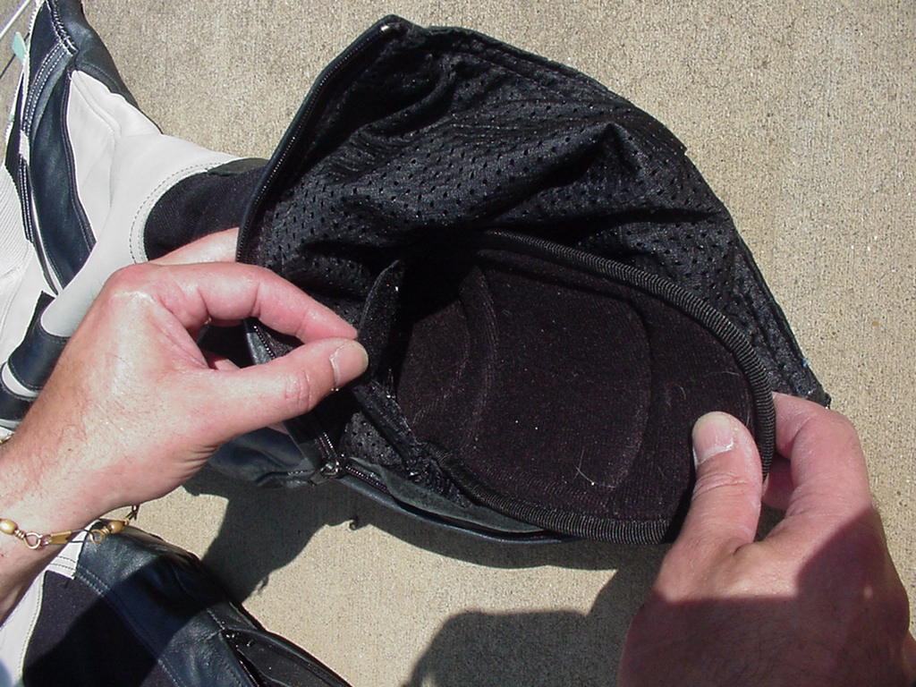
          The white suit that is the subject of this article has been down once onto a mostly grassy berm, mud soiling and scarring a few places on it, as shown in the photographs.  The suit also had some minor soiling in the crook of the arms, and dark areas where the inside of the black riding boots touch the lower legs.  


          The washing method used is detailed here: 
          Test for Colorfastness
          Use a dampened white towel edge to gently rub each color in the garment.  If there is little or no transfer of color to the towel and if there is no noticeable loss of color on the garment, this indicates that the quality of the leather components is high enough to allow wetting while cleaning.  

          Products Needed
          Woolite For All Colors Fabric Wash. 

          Lexol Leather Conditioner, Preservative. 


          Padded hanger for drying.  Slitting a foam plastic swimming noodle and slipping it over a sturdy wooden coat hanger is an inexpensive way to make such a hanger.  A noodle with a hole down the center works best.  Make sure the ends of the noodle cover the wooden coat hanger and that the noodle extends slightly into the sleeves of the garment.    


          Washing Equipment and Settings
          Domestic washing machine with as large a capacity as possible.  Either top or front-loading type is acceptable.  A top-loading extra-large capacity washer was used for this suit.
          Set the water level to maximum.
          Set the temperature for cold wash and cold rinse.
          Set the agitation and spin speeds to delicate or slow.

          Pre-Washing Procedure
          Remove all armor and padding that is removable.  These are usually fitted into pockets in the garment’s lining whose openings are closed with Velcro.  Sometimes the armor is accessible in pockets from the exterior of the suit. 
          Remove knee pucks. 
          If the garment is very dirty with mud or bug splats, hang it where it can be rinsed with a garden hose.
          Spray the garment with the hose until it is saturated.
          Use a clean sponge and a soft bristle brush to remove dirt from the surface, from the stitching, and from the seams.
          Rinse thoroughly.
          Immediately begin the Washing Procedure below without allowing the garment to dry.


          Washing Procedure
          Turn the garment inside out to protect the leather from the washing machine agitator and from zipper abrasions.  Close all zippers and Velcro.
          Partially fill the washing machine tub.  

          Add 4 oz of Woolite For All Colors Fabric Wash.  (Fill the Woolite bottle cap to the top.)  Agitate for one minute.  
          Submerge the garment completely and distribute it evenly in the tub to reduce imbalance during the spin portion of cycle.
          Wash only one item at a time.  

          Continue to full the tub to capacity.  Set the agitation time for 12 minutes.  When that time has elapsed, but before the wash water has drained, reset the washing machine timer for an additional 12 minutes.
          When the second 12-minute agitation portion of the cycle is complete, allow the machine to complete its cycle.
          Again set the washing machine to rinse, redistribute the garment in the tub, and allow it to fill and rinse a second time to thoroughly remove the detergent.  

          Meanwhile, clean the armor with mild detergent and a sponge, and the knee pucks with a brush.  Rinse and set aside to air dry. 

          Treatment After Washing
          Remove the garment from tub.
          Turn it right side out.  Do not wring it or stretch it excessively.  

          Hang it on a wide, padded hanger to avoid stretching the garment during drying.  
          Close all zippers and Velcro to help prevent the garment from stretching unevenly.  
          Two-piece suits can be zipped together and hung as one or can be hung separately.  (When the pants of a two-piece suit are hung separately, the spring clips of the pants hanger may leave depressed areas in the leather.)  If the garment is too heavy to hang, lay it flat on several bath towels.
          While still wet from washing, apply Lexol Leather Conditioner, Preservative by spraying or wiping it on with a clean sponge.  The conditioner should be applied until is just begins to run.  

          Use a clean cloth or sponge to smooth out runs, as these may cause streaking once the garment is dry.  Straighten out the garment so it has as few folds in it as possible.  Straighten the zipper flaps so they dry flat as well.  


          Drying
          Allow to air dry on the hanger in a heated or air conditioned room.  Do not dry near direct heat or in the sun.  A circulating fan is helpful in speeding drying, especially when the humidity is high.  

          Occasionally, shake or “pat” the leather to manipulate the leather fibers and promote flexibility.  
          If laying flat to dry, turn the garment over frequently and exchange the bath towels for dry ones to allow all portions to dry.  
          The suit in this article took about four days to dry while hanging in an air-conditioned room with free air circulating around it. 


          Afterward
          Once dry, again treat with Lexol Leather Conditioner, Preservative.  Wipe off any excess.  

          Allow garment to further dry for a day or two. 


          Results
          The suit is, in general, clean and bright.  There is no noticeable running of the colors.
          The leather is soft and supple.  

          The Lexol conditioner left a waxy finish that does not seem to cause excessive slipping on a synthetic leather motorcycle saddle.  
          The leather shrunk very slightly, probably to its original size.  
          The suit has been worn once since the washing, and it appears to have stretched a bit during that wearing, much as new leather would be expected to do.  
          The mud is almost all gone, except in some stitching and in scratches where the leather was abraded in the tumble.  
          The soil in the crook of the elbows was removed.  
          The marks on the lower legs from the inside of the boots were not removed by the washing process.  
          The sweat salt and stiffness in the other suit washed previously was removed without a trace.  

          These pictures taken after the washing process show the worst-soiled areas of the white suit.

          Some of the procedures described above were recommended by the makers of Leather Therapy preparations for cleaning leather.   
          Their products have not been tried by the author, though they are specially formulated for leather cleaning at home. They recommend their Leather Infusion Wash in place of the Woolite For All Colors, and their Leather Infusion Rinse afterward.  After that, use their Restorer/Conditioner if the garment seems dry.  They have posted some videos that show the procedure. 

          This shady-looking biker dude is showing off the finished product.  
          ----------------------------------------------------------------------------------
          Well, there you have it.  Now there is no excuse for wearing dirty leathers -- unless you want people to think you ride a lot.  


          Oh, no.  What have I done? 


           .

          Saturday, January 1, 2011

          Christmas Snow

          .
          Snow isn't common in South Carolina, and a white Christmas is even rarer.  The last one in our part of the state was in 1963. 

          Fred, a business associate of mine, has recently begun experimenting with his photography, and is doing quite well.  These are his pictures of Hagood Mill in Pickens County, taken the day after Christmas.


          Happy New Year
          .

          Saturday, December 25, 2010

          Early Christmas Morning Ride

          .
          The weather outside is [going to be] frightful [at least for South Carolina] later today:


          ------------------------------------------------------------------------------------
          AccuWeather.com ALERT
          SEVERE WEATHER
          EASLEY, SC
          URGENT - WINTER WEATHER MESSAGE
          437 AM EST SAT DEC 25 2010
          WINTER STORM WARNING IN EFFECT FROM NOON TODAY TO NOON EST
          SUNDAY...
          * HAZARDS...HEAVY SNOW.
          * ACCUMULATIONS...2 TO 4 INCHES.
          * IMPACTS...ONCE THE SNOW INCREASES IN INTENSITY IN THE AFTERNOON
          HOURS...ROADS WILL RAPIDLY BECOME SLICK AND DANGEROUS...
          ESPECIALLY BRIDGES AND OVERPASSES. HEAVY SNOW MAY ALSO BRING
          DOWN TREES AND POWER LINES.
          * PRECAUTIONARY/PREPAREDNESS ACTIONS...
          A WINTER STORM WARNING FOR HEAVY SNOW MEANS SEVERE WINTER WEATHER
          CONDITIONS ARE EXPECTED OR OCCURRING. SIGNIFICANT AMOUNTS OF SNOW
          ARE FORECAST THAT WILL MAKE TRAVEL DANGEROUS. ONLY TRAVEL IN AN
          EMERGENCY. IF YOU MUST TRAVEL...BE SURE TO TAKE ALONG YOUR CELL
          PHONE. WEAR A WARM COAT...GLOVES...AND BOOTS. KEEP A BLANKET...
          FLASHLIGHT...FOOD...AND WATER IN YOUR VEHICLE IN CASE OF AN
          EMERGENCY.
          ------------------------------------------------------------------------------------


          ...so I sneak out early this morning, before anyone else is up, for a quick ride. 

          It is 32 degrees, and I am out by 6:30, headed southeastward on SC-8 to Williamston, Pelzer, and Ware Place.  I watch the sun rise as I ride along.  The continually changing beauty I enjoy this morning can only be of God.

          I turn back toward Greenville, and ride through the nearly deserted streets toward home.  On the way, I notice the clouds have formed in rippled patterns.  It looks like snow to me.  I have never seen clouds like this before.   Maybe it is another gift from above.

          When I reach home, about 9:00, the temperature has only risen to 35 degrees, but I am not too chilled from my short 71-mile ride this morning.  I'm glad I went, as I may not be able to go out again for several days if the snow materializes. 

          I find another surprise at home.

          Someone has left presents under the Christmas tree, and some of them have my name on them! 

          No coal this year for Bucky!

          Merry Christmas to All 
          .

          Christmas

          .
          It is at this special time of year, that we would do well to hear the Christmas story once more.

          The prophet Isaiah.wrote about the coming of Jesus to earth about seven hundred years beforehand: 

          9:7 For unto us a Child is born, unto us a Son is given: and The Government shall be upon His Shoulder: and His Name shall be called Wonderful, Counsellor, The Mighty GOD, The Everlasting Father, The Prince of Peace. 9:7 Of the increase of His Government and peace there shall be no end, upon the Throne of David, and upon His Kingdom, to order it, and to establish it with judgment and with justice from henceforth even for ever. The zeal of the LORD of Hosts will perform this. 

          Luke wrote of the birth about thirty years after Jesus' death:
          2:1 And it came to pass in those days, that there went out a decree from Caesar Augustus, that all the world should be taxed. 2:2 (And this taxing was first made when Cyrenius was governor of Syria.) 2:3 And all went to be taxed, every one into his own city. 2:4 And Joseph also went up from Galilee, out of the city of Nazareth, into Judaea, unto the city of David, which is called Bethlehem; (because he was of the house and lineage of David:) 2:5 To be taxed with Mary his espoused wife, being great with Child. 2:6 And so it was, that, while they were there, the days were accomplished that she should be delivered.

          2:5 And she brought forth her firstborn Son, and wrapped Him in swaddling clothes, and laid Him in a manger; because there was no room for them in the inn.

          2:8 And there were in the same country shepherds abiding in the field, keeping watch over their flock by night. 2:9 And, lo, the angel of the LORD came upon them, and the glory of the LORD shone round about them: and they were sore afraid. 2:10 And the angel said unto them, Fear not: for, behold, I bring you good tidings of great joy, which shall be to all people. 2:11 For unto you is born this day in the city of David a Saviour, which is Christ the LORD. 2:12 And this shall be a sign unto you; Ye shall find the Babe wrapped in swaddling clothes, lying in a manger. 2:13 And suddenly there was with the angel a multitude of the heavenly host praising God, and saying, 2:14 Glory to God in the highest, and on earth peace, good will toward men. 2:15 And it came to pass, as the angels were gone away from them into Heaven, the shepherds said one to another, Let us now go even unto Bethlehem, and see this thing which is come to pass, which the LORD hath made known unto us. 2:16 And they came with haste, and found Mary, and Joseph, and the Babe lying in a manger. 2:17 And when they had seen it, they made known abroad the saying which was told them concerning this Child. 2:18 And all they that heard it wondered at those things which were told them by the shepherds. 2:19 But Mary kept all these things, and pondered them in her heart. 2:20 And the shepherds returned, glorifying and praising God for all the things that they had heard and seen, as it was told unto them. 2:21 And when eight days were accomplished for the circumcising of the Child, His Name was called JESUS, which was so named of the angel before He was conceived in the womb.

          If you don't know Jesus Christ as your living savior, then find a church that preaches from the Bible, and where they believe that it is the inerrant word recorded by writers inspired by God.


          They can explain the wonder of the birth of Jesus Christ and what it means to you and me. 
          .

          Friday, December 17, 2010

          A Georgia High Point (but not the highest)

          .
          November 27, 2010.  It was a cold morning -- about 32 degrees F -- so I did not think it was a good idea to go up onto the Blue Ridge Escarpment, in case there might be ice or slippery leaves on the twisty roads.  I elected instead to go west to revisit a couple of places I enjoyed near Toccoa Georgia.

          I have already installed my Hippo Hands for the winter, and my heated grips are at the ready to keep my tender little hands warm inside them.  I dress warmly, as is the usual case, and I am ready to go.


          Toccoa is about fifty-five miles from home, and I take one of the quicker roads, US-123, to get there.  I detour a bit on SC-93 into downtown Clemson South Carolina, since I have not been there in a long time.  I find that the tailgaters have already started setting up at 9:00 AM, despite the fact that the football game is at 7:00 PM.  Devoted, those Tigers fans.  As I leave town, I note that there is a Norfolk Southern freight train heading in the same general direction as I am. Maybe I'll see it again along the way.

          Oh. One good place to go to eat while in Clemson is Sardi's Den Restaurant.  They make some mouth-watering ribs there.  I had some that last time through.  They're located at 520 Old Greenville Hwy, Clemson, SC 29631, 864-654-7427. 


          I continue south (actually more west than south) on US-123, through sweeping curves, and finally reach the town of Toccoa.  I cruise through town, spotting the railroad station I visited the last time, and run toward the Trestle Falls housing development.  From there I can view the North Broad [railroad] Trestle, also known as the Wells Viaduct.  As an engineer, I am intrigued by the structure, built in 1919, which spans 1500 feet and is 202 feet above the North Broad River.

          It can be seen from the location at the end of the court that starts at Pushpin "B" on this map.

          View Larger Map

          I go a little beyond the place where I can view the trestle because I want to find the waterfall that is also here somewhere.  (That's why they call this Trestle Falls.)  I go to the very end of the road, but only find a pair of aggressively barking dogs there.  I don't stick around since one of the dogs -- a pit bull looking thing -- is nipping at my leg.   ATGATT helps many situations. I hurry out of there, so I never spot the falls. 

          I go back to the place where I can see the trestle, set up my camera, and wait for a train.  The one that I have been pacing since home finally arrives, heralded by its horn before I can see it or hear the rumble of the locomotives.  I didn't think I had been riding that much faster than it has been traveling: Maybe the train stopped somewhere on the way here.

          The track is upgrade to the west, so the locomotives are laboring a bit here.  I get a few shots, and after the train passes, I hear dirt bikes snarling somewhere in the hills on the far side of the trestle.  I heard them the last time I was here and had walked down to the base of the trestle, so there must be some good places to ride. In fact, the last time, I had hoped that they would give me a ride back to street level from the base of the trestle.  (They didn't show, so I had to hoof it up.) 

          I later looked at a Google satellite view, and found several trails over there the dirt bikers might have been using.  

          Here is a panorama of the trestle, made using PixMaker Pro.   
          It is not such a good time of year to take a photo, as the trees are not very colorful.  I'll have to come back again in the spring or fall.

          Here is an aerial photo taken by Joe Pusey and posted on the Railpictures.net website. It shows an Amtrak passenger train pulled by a GE P42DC locomotive on February 26, 2006, viewed from a Cessna 152 about 1500 above grade level.
          That's quite a view. My vantage point today is from about the eight o'clock direction. 

          I pack up my camera, remount, and then head to my other destination today, one that I have not visited previously, but wrote about last time. 

          That place is Currahee Mountain.  Technically a part of the Georgia Piedmont or "foothill" province, Currahee Mountain rises abruptly about 800 vertical feet (240 m) above the local topography and is the highest peak in Stephens County. Part of the mountain is in the Chattahoochee National Forest. On clear days, the peak's 1,735-foot (529 m) summit is visible for many miles and is a prominent landmark to the southeast of Georgia's Blue Ridge Mountain crest.

          My view approaching the mountain.

          The name Currahee (quu-wa-hi), given by the Cherokee Indians, is translated "Stands alone." During the Indian Wars the famous Indian fighter, Andrew Jackson, engaged the Indians at Fort Hill near Currahee Mountain in the "Battle of Currahee".

          During World War II, the mountain again became a part of a war. The U.S. Army selected Currahee as the site for its first Parachute Infantry Training Center to be named Camp Toccoa.

          You may recall that the mountain was still again made famous more recently by Tom Hanks' and Steven Spielberg's television miniseries Band of Brothers, in which it was featured as a training site of the Paratroopers at Camp Toccoa.  They ran up and down Currahee as part of their training. The name of the mountain became the motto for these paratroopers, including the famous quote, "Three miles up, three miles down".

          The last time I visited Toccoa, back in March 2010, I rode right past the road to the top of the mountain, but this time I find it and check it out.  It is at Pushpin "D" on the map above.  I park at the bottom, and walk a few hundred feet up the packed dirt road (puff, puff) to see if it might be passable on my Kawasaki Ninja 650R with street tires.

          I decide that it is [you've heard that before, right?], so I walk back down (much easier, so less puffing) to the bike, and start to ride up. 

          The road is known as FS65, or the Colonel Robert Sink Memorial Trail.  It is marked by this sign at the bottom:
          Colonel Sink was the first Commanding Officer of the 506th Parachute Infantry Regiment of Camp Toccoa, the “Five-O-Sinks”.  He was born April 3, 1905 and died December 13, 1965.

          Just above the beginning of the road, I spot the only remnant of Camp Toccoa; a block building that was the mess hall.  It sits behind a fence on a corner of the Milliken and Company textile plant property, so it is not accessible. 

          I continue onward and mostly upward.  There are a few roads branching off but I stay on the main road. Even though it rained a couple of days ago, the road is nicely packed dirt and gravel in most places.  There is occasionally some loose stone and many washboard sections.  At 0.5 mile there's an open gate. At 1.4 miles there's a sign saying, "closed 10 P.M. to 7 A.M.". At 2.8 miles, there's a good place to park near some large rocks with graffiti covering them.


          It's possible to ride slightly further, to very near the summit.  There are several communication towers and buildings at the top, all with chain link fences around them, making the area somewhat unsightly.  Pushpin "C" is at the summit. 

          The best view is from near the graffitid rocks, so I go back down there and stop again.  As I do, I note two men and two boys -- maybe a grandfather, his son, and grandsons -- standing and peering outward.  As I approach, the smaller boy -- about ten -- turns, his eyes become wide, and he nudges the other boy to look at what is coming.  I find a reasonably level place to park, turn off the engine, and dismount.  I don't bother taking off my helmet or gloves, since I am only going to take a few pictures.  I dig my camera out of the tank bag, then say hello to the group, and walk over to absorb the scenery.  As I do, I explain to the kids the importance of all the protective gear when riding a motorcycle.

          After a few minutes, the group of gents piles into their car and go off toward the summit, the boys watching continuously out the rear window.  I notice this and give them a thumbs up.  They return it eagerly with wide smiles.  I hope I made their day -- as they did mine.

          Here are a few pics from the graffiti rocks.

          A view to the right.  

          A view to the left.  That is a rock quarry on the far left.  The trestle is further to the left, though it is not visible from here. 

          And a panorama.
          That is my bike on the far right hiding behind some tree branches.  

          After taking in the view from this point on the mountain, I start back down.  I feel a bit more sure of myself in the few places where there is loose gravel, so I travel at a higher speed on the way down.  The washboard sections nearly vibrate my fillings loose, so I stand on the pegs like a dirt biker to reduce the potential dental bill.  For the engineers amongst us, here is a website that shows how washboarding begins

          The road at the base of the mountain, Dick's Hill Parkway, is smooth and a little curvy from the base of the mountain to the intersection of US-123 and GA-17.  It is fun to ride it.  In fact the Parkway toward the northwest from the base of the mountain is nice too, and it intersects again with US-125 a little further on, so you can easily get back to Toccoa that way if you wish. 

          As I pass through Toccoa again, I spot a mural on the side of a building.  You know that I like public murals, as I have written about the ones in Piedmont, and in Donalds and Iva, South Carolina.  


          This one is painted on the side of the Royal Crown Cola Bottling Company. They also bottle Nehi, the drink of Radar O'Reilly on M.A.S.H
          (That is a pile of cast iron pipe in front of the mural.)

          After I returned home, I made a few calls so I could report to you, loyal readers, about this mural.  I connected with the artist, one Pat Wise, and spoke with her on the phone.  She was happy to relate the story to me. 

          She said it is a whimsical piece showing several local attractions and historical sites including Toccoa Falls (with some artistic license applied), Travelers Rest east of Toccoa along the old Unicoi Turnpike, Lake Hartwell complete with sailboats and a biplane in flight over it, some whimsical houses and a church, and a golfer who some say looks a little like Ms. Wise's mustachioed husband.  I wrote about some of these places in my blog entry, Two Trips to Toccoa

          Here is a closeup of the golfer's form.
          Quite....er, unique.  (I am not a golfer, however, so who am I to say.) 

          As an aside, her hubby broke his leg (ouch) just after she started painting this mural, causing a delay in work while she helped him convalesce.  Ms. Wise also spoke warmly about inscribing the name of her then newly born granddaughter on one of the sailboats on the lake. 

          The final brush strokes were applied on July 4, 2003.  Another notable and nearby mural done by Ms. Wise is located in the Toccoa Airport terminal.  I'll have to visit there some time in future. By the way, I don't think she had anything to do with the "artwork" on the rocks at Currahee Mountain that I saw earlier today. 

          Since 1999, Ms. Wise has run her very own Laurel Hollow Decorative Art Studio, not far from Travelers Rest, where she conducts classes.  (She says she has good intentions of updating her website soon.) 

          I explore Toccoa a bit more, discover the forbidden motorcycle test course, then head back on US-123 to Westminster, take SC-183 to Walhalla, and eventually reach SC-11, the Cherokee Foothills Scenic Highway, then take US-178 home. 

          I have come to like the section of US-178 between SC-11 and Pickens, as a mildly curvy, well-paved stretch, with curves not nearly as tight as on the same road north of SC-11.  The sportier bikers like the latter better, and so might I one day, but for now, I'll go south. 

          My route of 167 miles today:

          View Larger Map

          It has warmed up to 57 degrees by the time I reach home, and it has been an enjoyable day out seeing some old and new sights on an easy route. 


          Nose Bleed Info:

          Definitions:
          • Elevation of a peak is the height of the peak's summit above sea level.
          • Prominence of a peak is the height of the peak’s summit above the lowest contour line encircling it and no higher summit. If the peak's prominence is P feet, to get from the summit to any higher terrain one must descend at least P feet.

          Nearby Peaks of Interest:
          • Currahee Mountain is the 23rd highest peak in Georgia, at 1735 above sea level with a prominence of about 800 feet.  Here is a video of a car trip from bottom to top
          • The highest point in Georgia is Brasstown Bald at 4783 feet above sea level with a prominence of 2107 feet. 
          • The highest point in South Carolina is Sassafras Mountain at 3564 feet above sea level with a prominence of 754 feet.
          • The highest point in North Carolina (and the highest point in the eastern United States) is Mount Mitchell at 6684 feet above sea level with a prominence of 6089 feet.
          You can ride to the top of all of these mountains.
          .

           .

          Sunday, December 5, 2010

          Harangue -- Georgia Department of Driver Services

          .
          harangue: An impassioned, disputatious public speech; A tirade or rant, whether spoken or written; To give a forceful and lengthy lecture or criticism to someone.

          I had occasion to ride to Toccoa Georgia last weekend, and toured several sights that are of interest.  I will report on them soon, but this harangue needs to be brought up immediately because it is so representative of government bureaucracy.  Read on to find out why. 

          I happened across the Georgia Department of Driver Services [DDS] driver test lot in town, where they test the parking skills of automobile drivers, and assess the maneuvering skills of motorcycle license seekers.  The lot is lined out for both type of tests, and there were traffic cones lining the "parking space" for use in auto driver parallel parking testing.  (Remember how difficult that was to learn?) 

          The motorcycle course delineations were painted on the sealed surface of the lot, but some of the seal coat had worn off and remnants of a different course were visible in many places.  This was a bit confusing; I imagine more so for a relatively inexperienced rider.

          It was also evident that the pavement surface had been subjected to considerable stress in the stopping distance portion of the test.  Not only is the surface worn, but there are deep scrapes.  Several people must have lost control in that part of the test.


          Well, these things happen, and it is better to have them happen in a controlled environment like this than on the road with traffic and other hazards. 

          ...or so I thought.

          After I looked over the course, and tried out a few of the exercises (you can never have enough low-speed practice), I noticed a sign near the lot entrance.

          I had apparently been breaking the law.  Oops. 

          So, here is a workable, if not perfect, motorcycle skills course layout, but use of it for practice is forbidden. 

          I called the Driver Services office there, and after a ten-minute wait spoke with a bored and disinterested woman who told me that it was, indeed, true that the lot is off limits to those seeking to practice either in a car or on a motorcycle.

          I probed a bit further, and she managed to tell me that the motorcycle course is also available for motorcycle classes given by the state, similar to Motorcycle Safety Foundation classes.  The test course is only for use during those classes and for license testing.  I persisted, and asked whether they also offer auto driver training.  No, they don't. 

          So here is a government facility, funded by taxpayers, that cannot be used to develop the skills it is intended to assess, while in the relative safety of a deserted parking lot. 

          What a stupid waste. This is one more reason to vote the bureaucrats out at every election, and to let them know of our outrage over their wasteful ways. 

          I did, with the bored woman on the phone.  I am sure she didn't care, but you, kind readers in Georgia, could make her care. The general DDS phone number is 866-203-4110.  Select option 1, then option 3 to speak with a real person -- maybe even her.  Ask for her supervisor, too.  Then onward and upward to the higher offices of the land! 

          ...if you can bear the interminable wait for someone to come to the phone.   


          Before I left, I took a few more laps around the course.  Naughty, naughty, Bucky. 

          .

          .